Hi,
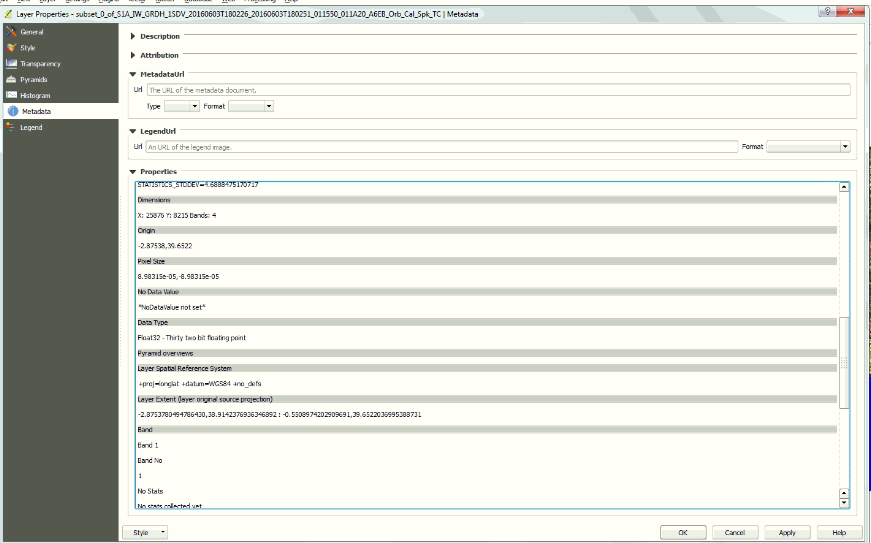
I would like to have a sentinel 1 product (of course after the calibration, speckle filter and the range doppler terrain correction) with a spatial resolution equal to 10 m but when the terrain correction finish I export the product as geotif and open it in QGIS and with the properties tool it indicated that the spatial resolution is equal to 8.9 m. I tried the resample it with the resample tool in SNAP but it was not possible to set a 10m ( the third option) it indicated an error. Does any one had the same problem, if so how it can be solve it ??
can you please show a screenshot of the resolution in QGIS?
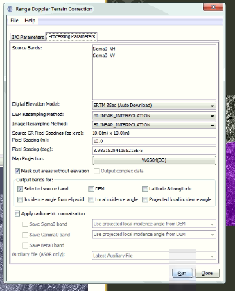
Yes of course, also I am including the processing parameters of terrain correction that I am using (I am not changing any parameters)
sorry for the bad quality of capture, this is a more close one
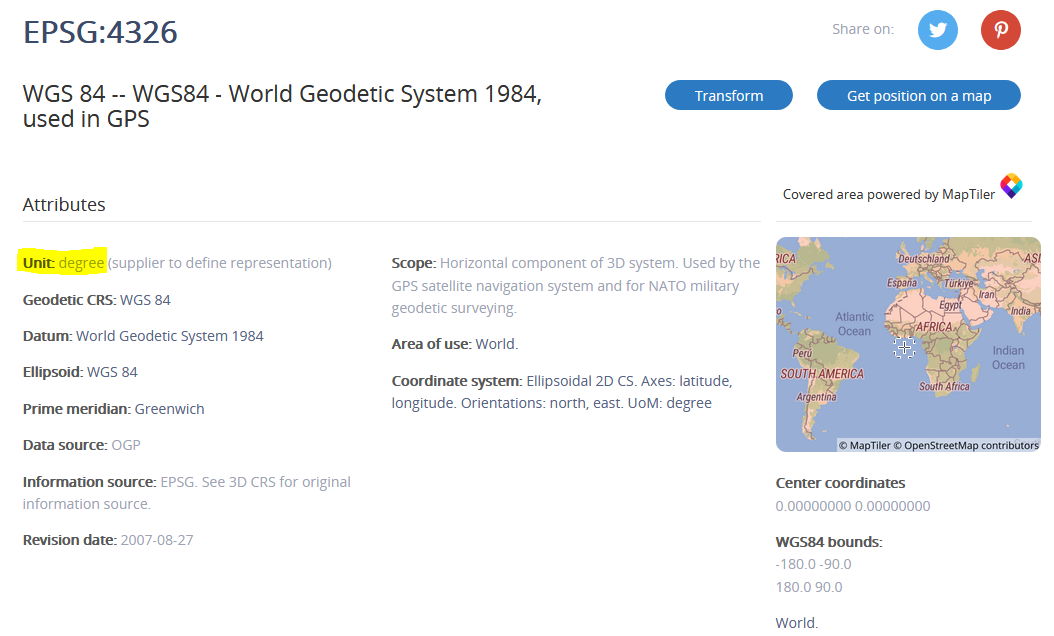
nothing wrong here. What you see in QGIS is no distance in meters but in degrees.
The target projection is WGS84, based on latitude and longitude. Accordingly, its unit is degrees .
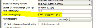
As defined in the output of SNAP, 10.0 meters are 8.9831E-5 degrees, that means 0.000089831 degrees.
If you want to have the spatial units of your exported data to be in meters, you have to set UTM as the coordinate system in the Terrain Correction.
thank you very much for this clarification, I changed UTM as coordinate system in the Terrain Correction and I get the spatial resolution in m