I have a source image (S1) in WGS 84 UTM 24 N projection. The source image is used for a segmentation analysis. The k-means segmentation process is used to segment the source image(S1) and output a new image(N1). The new segmented image (N1) however does not have any projection associated with it and the band is labeled as class_indices.
When I export directly from File>Export>Geotiff - it works but does not associate any spatial information with it.
When I export the view as a geotiff, by right click and choosing full resolution it throws an error - ‘Cannot export’, no details on it.
Is there a way to export the result of k-means segmentation as a geotiff file which has projection data associated with it?
Hi @ABraun, nope I did not create it using band math. The image generated after k-means classification is .img file format which is an ERDAS Imagine format. The conversion from that to geotiff does not result in any spatial reference information.
I then tried saving the classification result directly as a geotiff file but it still does not have any spatial reference when opening in ArcMap or QGIS. On defining a spatial reference in ArcMap, the k-means classification image still opens up as a file without spatial reference though when I look into the spatial reference meta data it shows it has it.
So what I am trying to do is to export out the segmentation file with spatial reference to begin with so that this issue with defining the projection later does not happen.
Which type of source product do you use? And which source bands do you specify for the k-means .
I see a check in the source code which can prevent copying the geoinformation to the target, but usually, it should work.
Hi @marpet, I am using GRD Sentinel-1 SAR product with IW swath. For the k-means I am using the GLCM texture bands that I generated.
Is there a step that I might be missing? The output band generated by k-means is an indices band. I went in and converted it into non-virtual band using Band Math.
I ended up writing a python script that does the k-means segmentation on the GLCM texture and output a binary image with projection metadata.
But I am interested in a solution within the SNAP toolbox.
Actually, the class_indices band is non-virtual already. I’ve used a Sentinel-2 product which is also in UTM projection and processed it with k-means and wrote to GeoTIFF. It had the correct projection and I was able to open it in QGIS for example.
Could you describe the processing steps in more detail and provide your input data.
HI sir ,i had the same problem ,which i need to export the sentinel -1 GRD produts form snap to Acrgis .however the geotiff image havn’t the space reference ethier.the image as follows: please reply me as soon as possible.
yeah,the last step is Range Doppler Terrain Correction,in the snap i had stick to the BEAM DIMAP format,the picture shown was in the arcgis ,which i had exported from snap already.
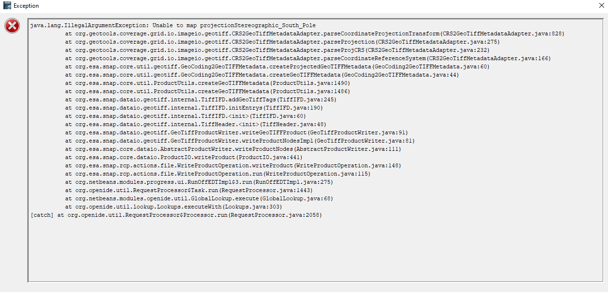
Hello, sorry to re-invoke the thread.
I have a couple of doubts (maybe really basic) regarding exporting the S1 pre-processed image to the geotiff. I get the following error.
My data is EW-GRD over the South pole (in stereographic-south pole).
Also, I need to convert the data because I want to do Texture Analysis, which worked previously with beam-dimap. But now, it gives me a Null-pointer exception, so I thought maybe converting the product to GeoTIFF would help.
I couldn’t.
I just tried to export the processed S1 data (which is corrected geometrically (EC) using Stereographic South pole projection).
Hence, the projection issue.
I had issues performing GLCM on the beam-dimap format of data, so I attempted to convert the format to GeoTIFF, which might help to process the data in QGIS too. But couldn’t succeed.
So you want geocoded textures but you cannot project the data nor convert textures.
I don’t undestand from your message if the data is already projected or not. But we should stick to one topic now, you distributed your problem over various threads, so I had to delete some of them to keep the forum clean.
Well, apologies for writing over multiple threads.
I just tried to figure out if it already existed and dropped messages thinking it would be relevant there.
Now, regarding the question,
Yes, I did project the scene (basic preprocessing is done till projection), applying textures is also possible.
I’m just unable to export it to GeoTIFF. It gives me the mentioned projection error.
And from the previous thread, after Textures, am unable to perform PCA on the same data. I’m pretty sure the textures has valid data as I cross-checked with histogram too.
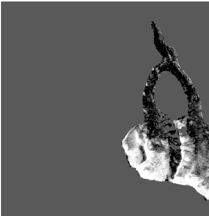
Shall I post how the histogram looks?
I’m sure, it’s projection error, but not aware of the reason.
And can I ask what the values of GLCM on a histogram represent?
After you mentioned, I cross checked the values on histogram- it’s quite varying.
Like dissimilarity shows: 0 -29, ASM: 0-4, Entropy: -1 to 10, Mean: 0 - 62 and variance is 0-1922. Can this be normal?
 please reply me as soon as possible.