osm
August 16, 2019, 5:56am
1
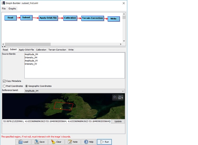
I was trying the subset an area from Sentinel 1 GRD zip file using the following graph builder and WKT coordinates.
Graph_builder: |690x83](upload://fQXurdeRwyuu5c7I1bxC15cuSei.jpeg)
WKT polygon coordinates:
POLYGON ((-6.633369 53.184910,-6.449935 53.190299,-6.446312 53.087612,-6.634983 53.081792,-6.633369 53.184910))
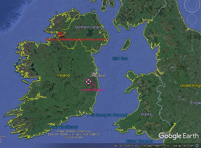
As you could see in the image below, when I try to overlay the subsetted image in GIS it is not aligning correctly.
Surprisingly, if I do the same steps using GUI, the subsetted image is aligning correctly in GIS.
As I have to subset more than 100 images, I would be grateful if any one of you could suggest what I am doing wrong here.
osm
August 16, 2019, 6:25am
2
Just a follow-up on my above post. It seems like the Graph Builder image didn’t upload correctly.
Could you make the subset as the first operator after Read, and then check up the results,
osm
August 16, 2019, 8:45am
4
As you suggested I have tried to subset the image as the first operator following Read and I have been getting the following error message:
That’s mean the polygon doesn’t intersect with the AOI,
The first option now is to apply all steps manually as test, concerning the step of subset convert the wkt to shpfile, and then use it,
The second option is to make the subset operator after apply orbit, also do this manually,
Please let me now if it helps,
osm
August 16, 2019, 10:47am
6
As I posted earlier, if we do it manually through the SNAP GUI it works perfectly.
However, if we try to automate it it through Graph Builder (Read-Apply orbit file- calibration-terrain correction-subset-write) using WKT polygon coordinates, there will be an offset of roughly 200 km to North-West.
I tried five different Sentinel 1 GRD files and none of them align correctly in GIS using the above graph.
I think the crs in degree, ESPG:3426 , is that right?,
osm
August 16, 2019, 12:01pm
8
WKT polygon coordinates are in WGS84/Geographic (EPSG 4326).
I think SNAP can take WKT in geographic co-ordidnates (Lat/long decimal degrees) .
Actually it seems the operator in GB, couldn’t read also in meter, because I faced up same problem, Hopefully we could get an answer from the developers.
osm
August 16, 2019, 1:13pm
10
Just come across the following thread which discuss about subsetting issues using WKT/Shape format.
You can can create a subset using a polygon in WKT format.
You could also mask the data within your vector using the Land/Sea mask operator. It can take as input a vector found in the source product. This would make anything outside your vector no-data-value.
If you source product does not have the vector you need, you can use the vector/import-vector operator to add a shape file to the product.
Subsetting directly from a shape file or source product vector would be useful. I’ll add it to the…


