Hi,
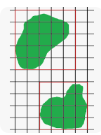
I am looking for a way to obtain the pixel grids of a satellite image over a study area so that it would be possible to collect the field data within that Sentinel-2 (20*20 m) pixel. I have attached a picture of what I am looking for. Is there a way to get such grids for a sentinel-2 tile?
Thank you very much.
Any help would be highly appreciated
You can download the data from various sources.
Then you can oopen the data in SNAP and can see the grid. You can resample the data to 20m. Then you have a common grid of 20m. With the subset tool you can tailor the data to the region and the chanells you are intereseted in.
You can extract the raw data from the original copernicus file (I highly suggest subsetting it first to your specific AOI) into a csv file either in SNAP or using a graph with gpt. Make sure to include the latitude and longitude. You can then read that csv file and create a geojson Features collection where each Feature’s centroid is the associated lat/lng pair, and attach your field data as properties to that feature.
Then with the Features collection you can create the kind of grid you are looking for. Check out the Turf library for useful geojson operations.