Hello,
I have download a “S2A_MSIL2A” product which I understand is already atmospherically corrected (as if Sen2Cor was already applied to it), is this correct?
However, I saw that the pixel values appear to be in radiance rather than in reflectance:
I also tried to open an RGB of the product in SNAP unsuccessfully.
When I opened the product I found a very different order of folders from that of other Sentinel products: in the folder “GRANULE” was another folder “L2A_T20JMT_” with the “MTD_TL.xml”, which I tried to use to open the complete product in SNAP to construct an RGB however did not work…
In the folder “L2A_T20JMT_” a folder called “IMG_DATA” contains the bands in more folders separated by pixels size: “R10m”, “R20m” ,“R60m”.
How can I open an RGB in SNAP of this product and how can I export a solely band to GeoTIFF file to be open in QGIS?
Is any correction factor needed to be applied to the exported GeoTIFF file for this case?
The provided data are reflectance values but the QUANTIFICATION_VALUE needs to be applied to jp2 images. This value is 10000 and specified in the MTD_MSIL2A.xml file.
This is also the file you should open in SNAP. The QUANTIFICATION_VALUE is then applied automatically. Then you see all bands at once and you can easily create RGB images and export to GeoTiff.
But when exporting to GeoTIFF the raw values are exported without the QUANTIFICATION_VALUE applied.
If it should be applied you need to create new Bands by Band Maths.
Create for each RGB channel a new band
// bandName = expression
blue = B2
green = B3
red = B4
Thanks a lot for your help !! Following your indications I could open the product, create an RGB, and also as you mention values were automatically converted to reflectance
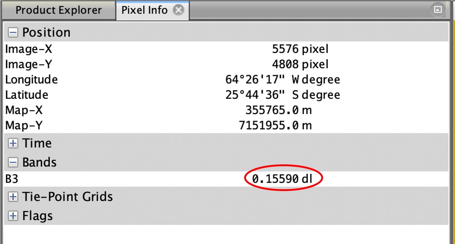
Since when I clicked “information” icon of the product, no “scaling factor for converison” was shown: for converting the values of the extracted band in GeoTIFF file format to reflectance I should divide the pixel values by 10000 or multiply then by 0.0001, is this procedure correct to get reflectance in the GeoTIFF file?
Hello Marco,
I done a subset of green band of product S2A_LMSIL2A and got the following min = 1E-4 but a max = 1.9440 shouldn’t be between 0 and 1 since is reflectance?
Such a value is not common, but you always have outliers.
And check this post of @OHagolle and also the link to the blog he posted. This shows that reflectance values can be above 1.
Thanks a lot!!
Is it a good procedure and practice to limit the reflectance to be between 0 and 1?
Meaning to eliminate by filtering all possible outliers and keeping only values of reflectance which are in range between 0 to 1?
Thanks a lot,
Regards,
I also think this depends on what is done with the images. Some approaches based on spectral characteristics (e.g. spectral unmixing) would probably benefit from corrected outliers, but in general, I see no problems with values above 1 (e.g. for supervised classification).