Hi.
I would like to support monitoring the ghgases emissions and their potential concentration change during wintertime in some cities in greece. Is possible to exploit the tropomi observations and data?
thank you
evi
Hi.
I would like to support monitoring the ghgases emissions and their potential concentration change during wintertime in some cities in greece. Is possible to exploit the tropomi observations and data?
thank you
evi
You can download TROPOMI NRT L2 data from Copernicus Open Access Hub website, and then dispaly with Panoply tool. My result for Jiangsu Province (in easter China,neighbour of Shanghai) on December 18,2018 is as following:
Thank you very much, indeed. I’ ll try that what you’ve said.
evi
Hello! do you know where to download Panoply and if Snap latest version is able to read this file?
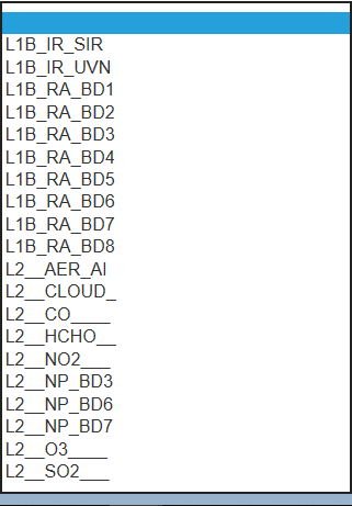
Also I visited the sci hub for sentinel 5p https://s5phub.copernicus.eu/dhus/#/home but among the product types does not mention CO2 or CH4 as you can see in th image.
Do you know if it possible to download them?
Thanks
Michele
Sentinel5p is not explicitly supported by SNAP, it can only read the NetCDF in a generic way.
But you can use BEAT. Have a look here:
https://sentinel.esa.int/web/sentinel/user-guides/sentinel-5p-tropomi/software-tools
The download of Panoply can easily be found by a web search.
Here you are: https://www.giss.nasa.gov/tools/panoply/
Thanks @marpet !
Do you think that snap will support this kind of data in the future?
This is not planned at the moment.
But “never say never.”
Hi Marco,
I didn’t find any category related to Sentinel 5, since I’m using python not SNAP, but the question is, Do you have any idea of downloading the part of the orbit and not the entire orbit!
Is this possible and how?
Many thanks
If you use R and you wish to download specific S5p products at a specific lat/lon, you may use the library I’m developing:
Feel free to ask questions about it, if interested.
Hi
Is this work on java? so it requires java programming for install
Which tool do you refer to?
SNAP is written in Java but brings it’s own Java instance during installation.
BEAT uses several languages as far as I know.
For Panoply you need to install Java first.
Thanks for your reply.
l want just export Sentinel5P images to tiff or another format. and estimate pollution.
is there another way produce?
one of these software ( CODA, HARP, VISAN,QDOAS) useful?
Thanks a lot, for you very nice response, I actually use python, and I found also this very useful
But also to download the entire orbit.
How can I convert Sentinel-5 methane data units from parts per billion (ppb) to ground-level data units in micrograms per cubic meter (µg/m³) ?
