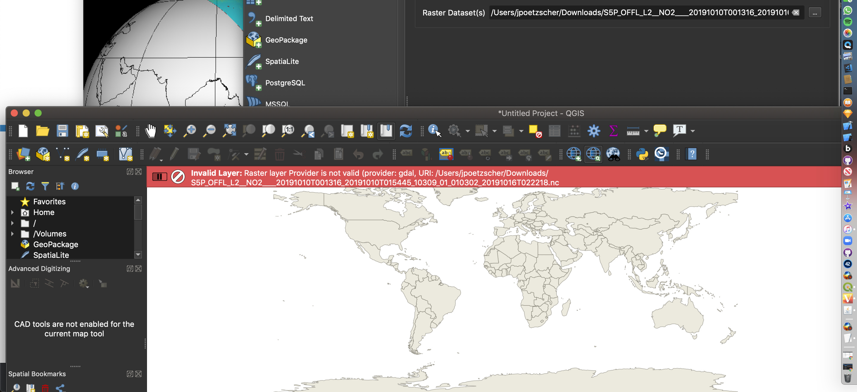
Hello All. I have been downloading the NO2 CH4 and other data from the Sentinel 5P and have tried using panoply to map it. The issue is that panoply only allows the merging of two arrays and this doesn’t allow me to map global concentrations. I was pointed to QGIS by an expert in this field but when I tried to open the file in QGIS I got an error message. (I provided a screenshot) How can I go about solving this issue.
In QGIS there is a NetCDF Browser plugin to open nc files. Not sure if it comes by default.
Another possibility is to convert nc to geo tiff, I think there is a “gdal translate” option, or you could do it from SNAP.
you can not translate with gdaltranslate. If you process tha data from Level 2 to level 3 using harp. you can visualize it on q gis with your desired subset of data