Hi all,
I’m using snappy to apply in batch subset and reproject functions on Sentinel3 L2 WFR products. Sometimes, this works as expected and results match perfectly well the land mask in my AOI. But some other times, there is a slight shift (not always in the same direction) between the mask and the result.
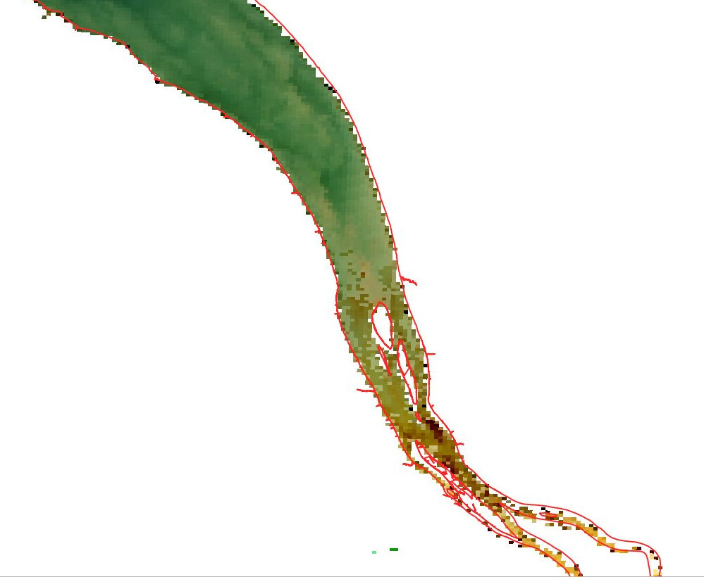
This first result works well.
Image ID : S3A_OL_2_WFR____20180802T101253_20180802T101553_20180803T172429_0179_034_122_2160_MAR_O_NT_002.SEN3
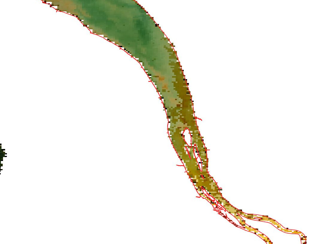
This one is shifted to the SW.
Image ID : S3A_OL_2_WFR____20180805T103519_20180805T103819_20180806T180342_0179_034_165_2160_MAR_O_NT_002.SEN3
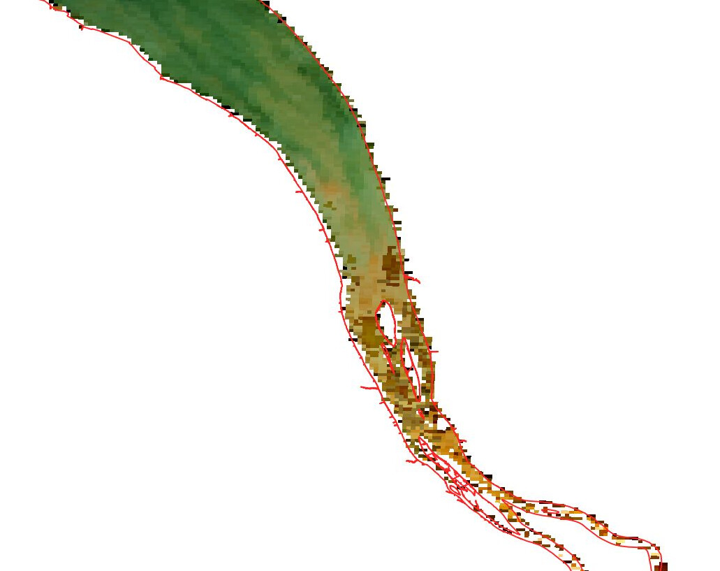
And this one is shifted to the NE.
Image ID : S3A_OL_2_WFR____20180806T100908_20180806T101208_20180807T183411_0179_034_179_2160_MAR_O_NT_002.SEN3
Here are the codes I use for subset and reproject
Sentinel3_reproject.py (2.4 KB)
Sentinel3_subset.py (2.6 KB)
At first, I thought this might be related to the distance to nadir of my AOI within each data. But looking at the whole images, it doesn’t seem to be the case. Is there maybe an option in the reproject function that should be triggered to avoid these slight shifts ?
Thanks for your help!
Olivier