Originally published at: SNAP 12 Released – Celebrating A Decade of Earth Observation Tools – STEP
We are excited to announce the release of ESA SNAP 12, marking 10 years since the very first release of the Sentinel Application Platform on 5 May 2015. The new version introduces significant updates for SAR, optical, and atmospheric data processing workflows. Here’s a breakdown of what’s new: ![]() Core Enhancements: Updates to JDK21 showing…
Core Enhancements: Updates to JDK21 showing…
5 Likes
Thank you for the update/information, Diana. Thank you very much, and congratulations to the SNAP team for all the involved work in the last 10 years!
Cheers!
1 Like
Hey! Congrats for the release. It is great to have to updated version. Especially I’m happy of the JDK 21 update. Finally, SNAP uses a recent Java version.
But I have to report also a first issue. When try the raster to vector operation I found issues.
I have simply used B1 of Sentinel-2 and the following parameters for the quantification.
<parameters>
    <bandName>B1</bandName>
    <intervalsMap class="java.util.HashMap">1,0.0,0.15;2,0.15,0.4;3,0.4,1.3;</intervalsMap>
</parameters>
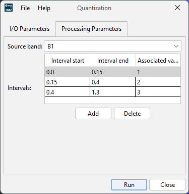
Which leads to this result:
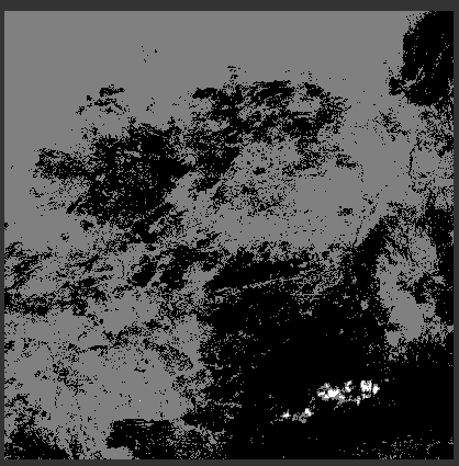
So far so good.
But when using this result with the RTV operator the result it not usable.
The shapes are not present, and the geo-location is wrong.
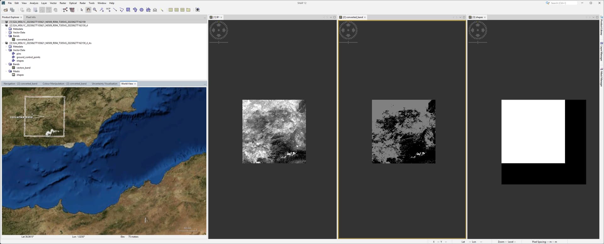
The original location is 1. The converted_band has already some border. While the product 2 which contains the converted_band is at a different location. Together with product 3, the final RTV product.
The shapes, as masks and geometrys, look like this:

Depending on the zoom level the shapes mask can look like


The raster vectors_band is completely empty.
I’ve used the product S2A_MSIL1C_20230627T105621_N0509_R094_T30SVG_20230627T162159
Additional feedback:
- It would be good to let the user store presets for the intervals. This would allow to use the same values easily. It was already now annoying to enter the values again and again.
- The quantification operator has the target product suffix ‘_rl’. I think ‘_quant’ could be more meaningful.
- Besides using the raster to vector as operator it should be possible to use them in place on a product and let them only generate the vector. Like Band Maths.
Thanks again for the release.
Ciao
Marco
Jira ticket SNAP-4015 created
I have one doubt. Sorry to ask here because i was not getting how to post it. I am working with sentinel-1 SLC data over a glacier. I followed following steps:
- Apply orbit file
- S1 split and select IW3
- Radar-Calibrate
- Deburst
- Range Doppler Terrain Correction
- Export as envi format
I want the SLC complex data so I checked for it not for sigma naught and beta naught. But when i observe the data, i found extreme values for i and q bands of both VH and VV.
Statistics for iVH:
Min : -3.4027579542022688e+38
Max : 3.4027839156865615e+38
NaN Count: 2364
Statistics for qVH:
Min : -3.4005773923457802e+38
Max : 3.401382198358853e+38
NaN Count: 2398
Statistics for iVV:
Min : -3.3991237520494865e+38
Max : 3.3999802782070487e+38
NaN Count: 2278
Statistics for qVV:
Min : -3.4018231379436365e+38
Max : 3.4020829556106593e+38
NaN Count: 2346
Please let me know what could be the possible reason and how to correct it.
Are the results correct in one of the two internal formats? (.znap or BEAM-Dimap?)
Yes, when i checked pixel info of of Terrain corrected file, i can see reasonable values.
Product: S1A_IW_SLC__1SDV_20161105T172310_20161105T172337_013810_016316_0FA8_IW3_Cal_deb_TC
Image-X: 5367 pixel
Image-Y: 9110 pixel
Longitude: 8°18’19" E degree
Latitude: 46°07’20" N degree
BandName Value Unit
i_IW3_VH: 0.03447 real
q_IW3_VH: -0.04537 imaginary
Intensity_IW3_VH: 0.00970 intensity
i_IW3_VV: -0.01892 real
q_IW3_VV: 0.04645 imaginary
Intensity_IW3_VV: 0.01387 intensity
latitude: 46.12218 deg
longitude: 8.30520 deg
localIncidenceAngle: 39.68927 deg
incidenceAngleFromEllipsoid: 43.40176 deg
Are Microsoft Planetary Computer sentinel 2 products able to load through .xml file now? @diana_harosa
I do not know for sure but I doubt it - Esri (ArcGIS owner) reprocesses the archive for the Planetary Computer, and they do not have further processing in SNAP in mind as a use-case.
fair enough, but still, in SNAP v11 there was this new functionality published:
- Add support for STAC+COG formatted products
and still can’t understand where is the support and which STAC providers does SNAP support @diana_harosa
A STAC client was added that can connect to catalogs and APIs. It gets used to pull the ESA WorldCover and ESRI land cover from Planetary Computer. The API can be called from Java through the snap-stac module but it has not been fully integrated into the Product Library to search and download products.