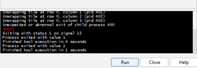
Has anyone done Unwrapping with SNAP 12?
I keep getting the error:
Error: [NodeId: SnaphuExport] Cannot invoke
“String.contains(java.lang.CharSequence)” because the return value of
“org.esa.snap.core.datamodel.Band.getUnit()” is null
And when I manually change the unit to rad from properties, it says Wrapped phase is needed.
I had to revert to SNAP 11. I think there might have not been perfections on SNAP 12 so I will hold on for a while till I can confirm bug fixes have been done.
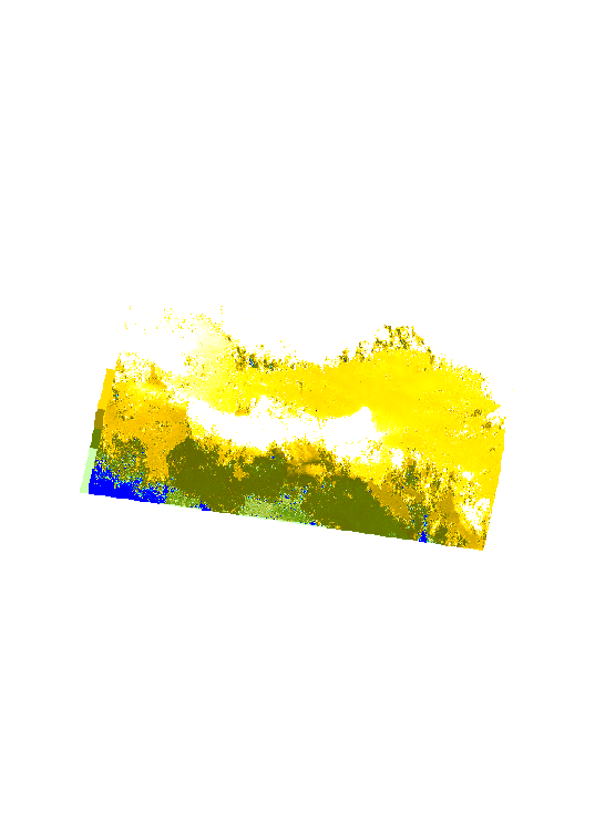
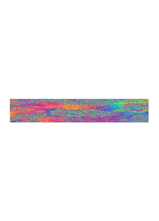
can i ask something i have problem myself i do unwraped but my unwraped phase is likde destroyed and cant give me displacement i need can you tell me steps you do and what is a good time diferent for my sentinel-1 images? and if i go for gmtsar do i get better result my images have alot of noise even after gold stein i realy need hellp here
Can you upload what your unwrap phase looks like?
That way I can assist.
Better result can be gotten when you use Multilooking but you would be sacrificing a lot of details. It is best used when the area is so small that you are just after a specific point or points.
THESE ARE MY RESULTS can you tell me what to do and why is it so bad ? i dont multilook becouse then it all would be destroyed in unwraped procces i dont get it is it my time diferenses are they too much? should i just get a 12 day diferense i would apreciate hellp
What was your temporal baseline? If it is more than 24 days, You may need to reduce it. 12 days is most preferred, then revert with your results. From the images you sent, the unwrapped phase has a lot of noise, hence the speckles. Reduce the baseline and try again.
it is 48 days ihave one more question if i whant landsubsidense for one year should i do it like these? am=nd fact that my are have mountain has to do with these many noise? can i ask something does it mater i use assending images or desendings images from sentinel-1? i realy dont know how it works or diferent they are i ma using it to get displacement
here are my steps
1_s-1 topse ESD coregistration
2_interferogram Formation
3_deburst
4_topographick phase removal
5_goldstein filter
6-export by snap.8
7-doing unwraped by cmd
9_import by snap12
10_displacement
11_range doppler terrain correction
is there something wrong i do?
I would recommend using a shorter baseline of 12 days. And if you want land subsidence for 1 year, that would mean you can try using SBAS Technique at 12 days baseline. If there are no 12 days consistently for your 1 year area, you can bridge the missing ones with 24 or 36 days but be sure to state it in your analysis so the huge jump can be properly explained and accounted for. Yes, a mountainous area would come with quite some noise and if it a heavily vegetated mountain, the accuracy using Sentinel-1 C-band might be low compared to using ALOS-2 L-Band hosted by JAXA (But this isn’t free and available for every area). You can use any direction, ascending or descending but you must be consistent with which ever you choose. It is just the flight Orbit direction influencing how the burst in each swath appear (either 1 - 10 from top to bottom or bottom to top. What you can do for land subsidence is pick VV polarization when splitting (VV meaning Vertical Send, Vertical Receive) and keep it that way too for all images.
Please read up on the SBAS Technique too and see if it helps you with your time series analysis for a year.
Sorry, I want to know you install version 8 and 12 in the only computer? Because when I try install two version at the same time, only one run, another is error. Thanks