my planned workflow is as follows:
Data download → sen2cor → Mosaicing → Spectral/Spatial Subsetting → Export GeoTIFF
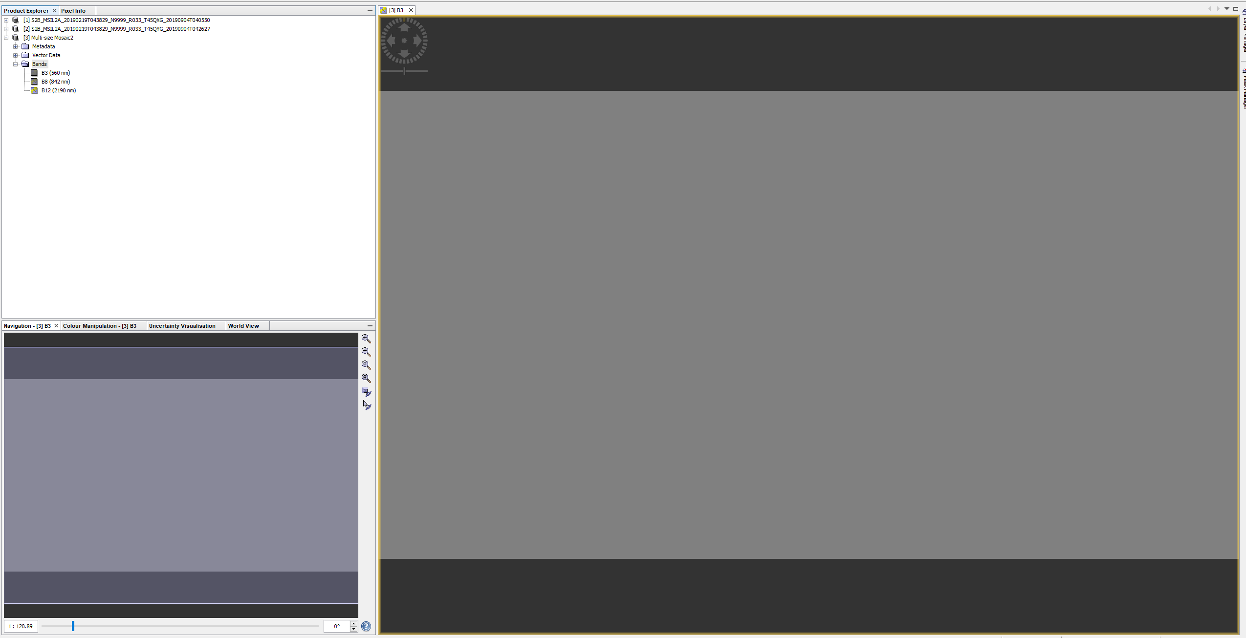
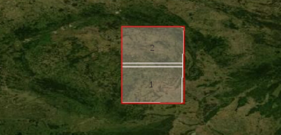
Resampling to 10m must also be a part - but it does not matter if it is done before or after Mosaicing. I followed both tutorial videos (Mosaicing and Multi-Size Mosaic) with the proposed properties, but in the end the output does not show an image. Mosaicing of course quits with the error that there are bands with different resolutions. I even resampled my data before. But after mosaicing, when opening a specific band, there is only shown a black space.
After Multi-size mosaic processing this is produced when I like to show a band:
Has anybody experienced similar difficulties and has a solution on that issue? The only difference to the tutorials is that I am using L2A instead of L1C images.
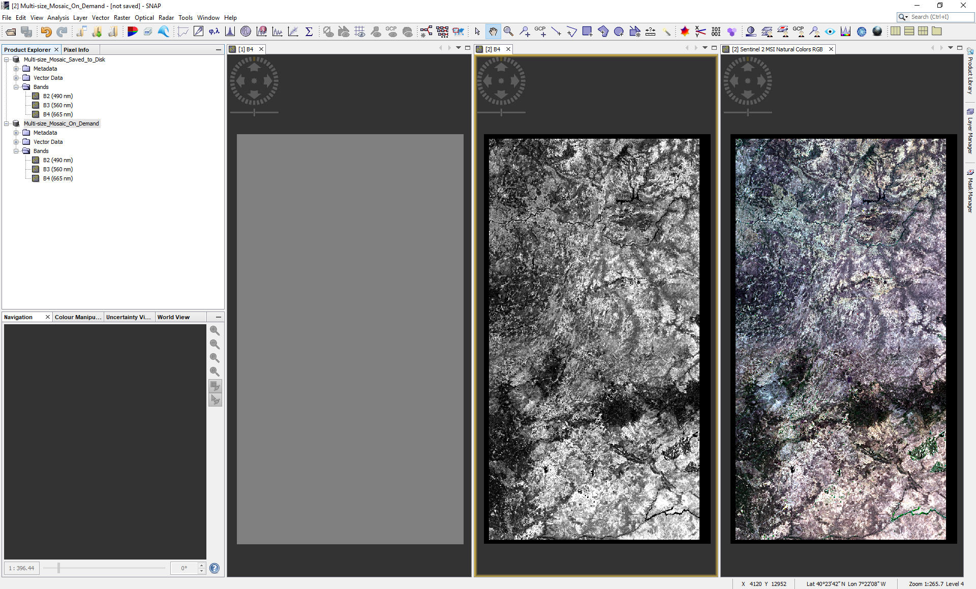
I already solved it, but the exact workflow is written on paper in my office. I will attach it to this topic tomorrow. As far as I remember, I resampled both datasets, saved that as BEAM-DIMAP, used the normal Mosaicing Tool, saved that again as BEAM-DIMAP, opened a new program window, loaded the BEAM-DIMAP and exported the data to GeoTIFF. In the Save as export dialog there is another button for creating a subset. I used that and magically my bands were there.
Resampling Tool, resampling is based on a band reference
Saving as BEAM-DIMAP
Loading the BEAM-DIMAP into SNAP, Mosaicing Tool:
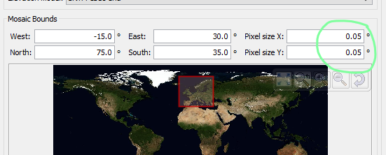
In Map Projection Definition I chose UTM/WGS84 (automatic) from the list; in the box “Mosaic Bounds” make sure to change the corresponding field to your required pixel size. In the Variables & Conditions tab I chose my desired bands. Save the new images as BEAM-DIMAP. Now there are still metadata bands included that need to be excluded if you want to export it as a GeoTIFF.
Loading BEAM-DIMAP into SNAP (I did it in a fresh environment).
Export the Image as GeoTIFF. In the export dialog, there is also a subset button. Use that to at least exclude the metadata bands. There will be a warning you can ignore.
Open the the GeoTIFF an a GIS of your choice (tested in ERDAS & QGIS).
I do not know why it is needed to save it several times, but for me it worked like this.
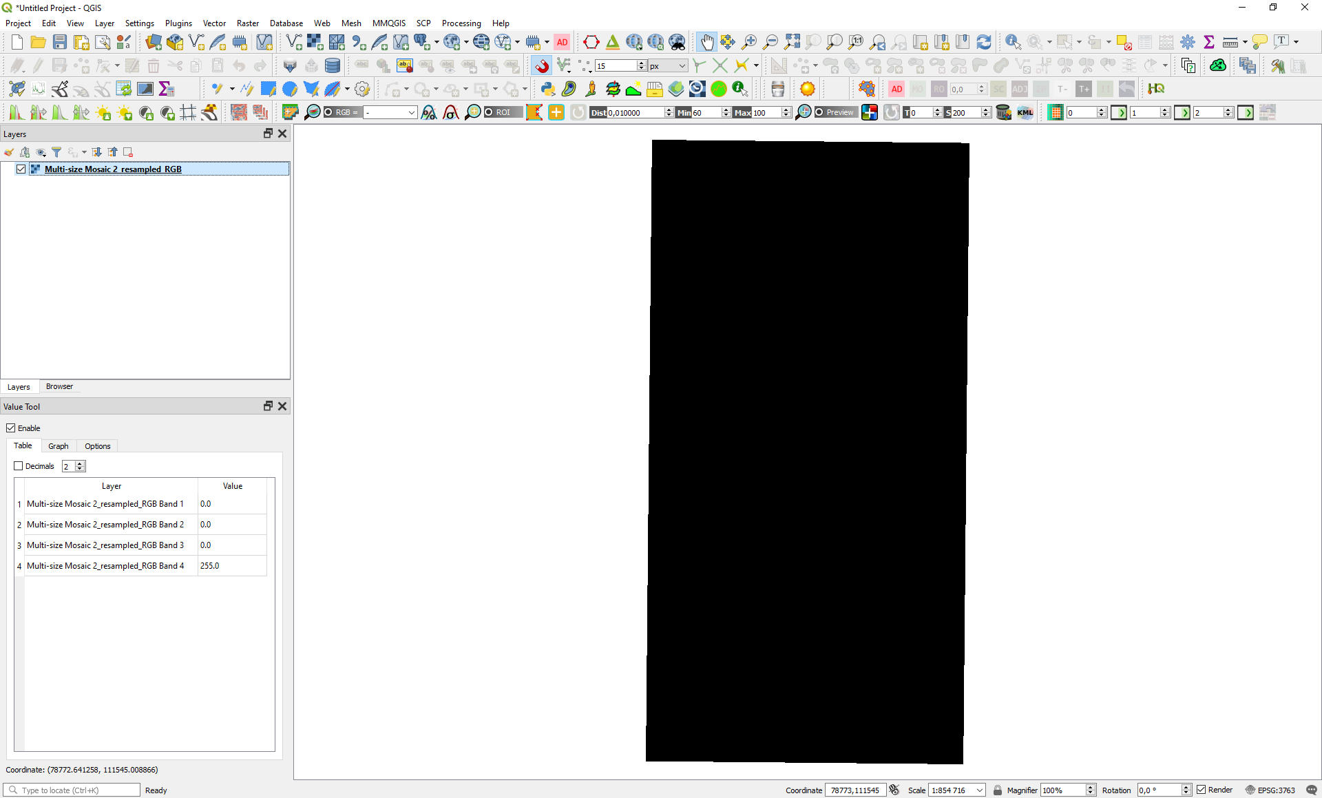
I am also not able to connect two bordering (overlapping) S-2A products. Tried several approaches however the result is always the same (picture). I can definitely elaborate steps if needed!
I’ve resampled the size of the images according to the B2 band (so resolution 10m) and save it on the drive
Raster/Geometric/Mosaicking → open resampled dim files
a) Save as BEAM-DIMAP; Custom CRS; All bands in Variables; No conditions → run
b) Save as BEAM-DIMAP; EPSG 4326, Elevation Model - Copernicus 30m; All bands in Variables; No conditions → run
c) Save as Geotiff; EPSG 4326, Elevation Model - Copernicus 30m; All bands in Variables; No conditions → run
All three combinations resulted in the same output (image in the first contribution). So it is some strange resolution of two merged images? Maybe? I am not quite sure
Okay great, it is working. I am so sorry! I didn’t assume that there will be a different default resolution than one of the used images. However, now I see why - 100 gb per one mosaic Thanks!
Yes, it can become big.
Maybe you can exclude some bands to reduce the size?
You can also try NetCDF4 as output format. The supported compression would shrink the amount of data.
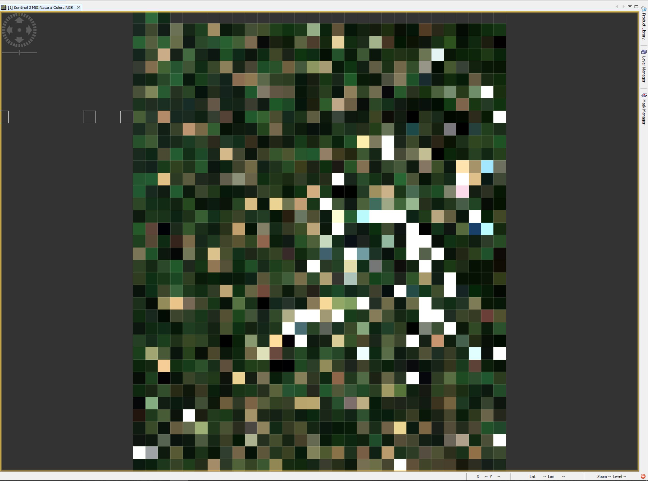
someone have idea why the digital values change after made a mosaic. Before the digital values were in scale of 0 to 65536. But after the values change to values that have a range between 0 to 2.