how can i know the accuracy of displacement which is estimated by snap tutorial(tops interferometry tutorial) is it related to coherence?
the results do not contain information on accuracy. DInSAR follows a complex workflow and offers many potential error sources (decorrelation, atmospheric effects, unwrapping errors). The best way to estimate the accuracy of the results is to carefully check the output of each step (visually) and only proceed if you are convinced that the intermediate products are ok.
Coherence is an indicator on the quality of the phase, so you can use it for the interpretation of the interferogram.
In the end, your only way to quantitatively asess the accuracy is to link it to independent measurements (gauging stations, GNSS measurements of subsidence), but these are not available in most cases.
Some points to start:
- what’s the temporal and perpendicular baseline?
- how does the interferogram look like after filtering?
- do you have enough high coherence areas?
- did the unwrapping correctly process the fringes or is it randomly adding up noisy phase pixels?
- is the value range of the result (line of sight displacement) feasible?
1 Like
Hi dears
I processed 24 sentinel-1A images in SNAP.8 and obtained displacement average map showing in attachment. Now I need to find mean, standard deviation, median of displacements. Is there any way in SNAP giving me all point displacements information on displacement image?
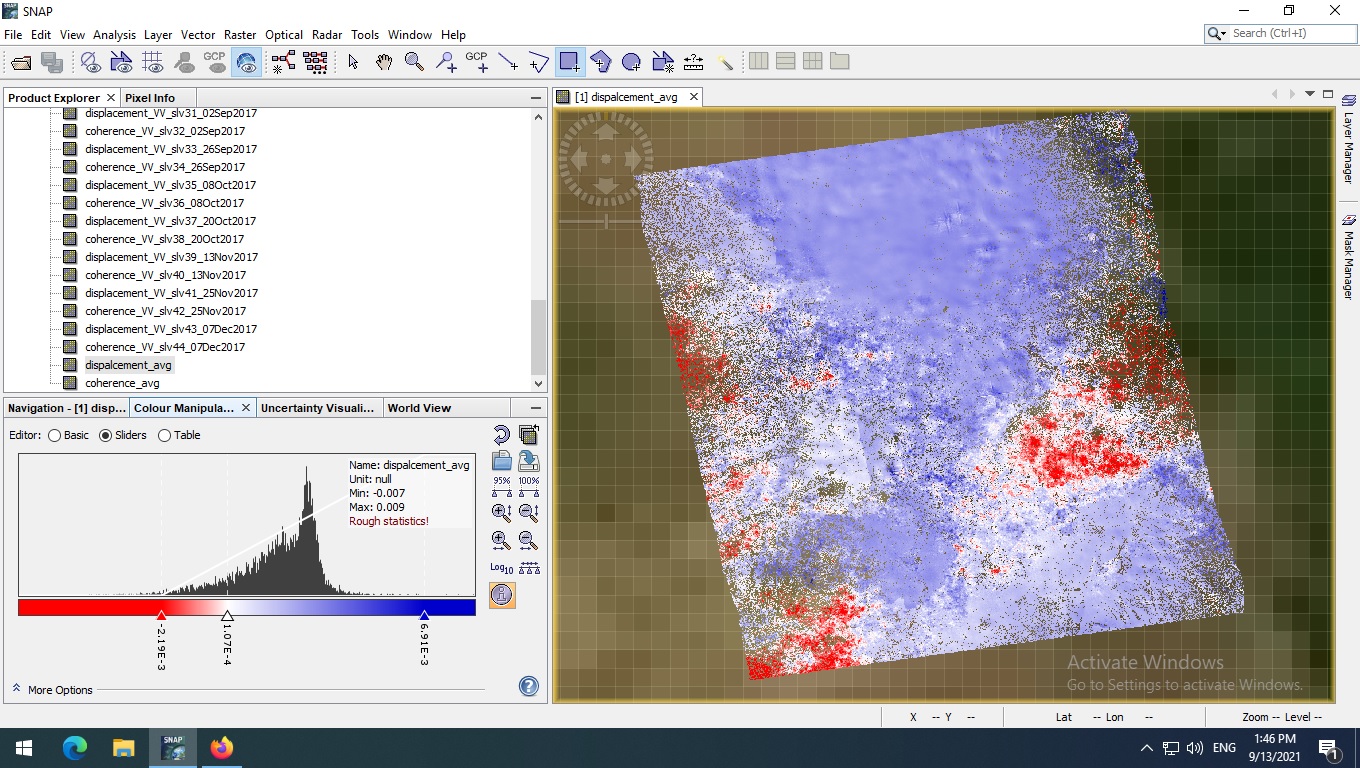
you can use the Select Band operator to create a stack of displacement bands only and then apply Radar > Coregistration > Stack Tools > Stack Averaging to calculate their mean and standar deviation (unfortunately no median).
Thank you so much dear ABraun. I tried this way, but unfortunately it is not sufficient for me. Is there any way to export this displacement map to GIS format? If I could export to this format, I would export all point displacements from Arcmap as an excell file and I could do statistical calculation on data.
cou can directly read al img files in ArcMap without any additional step.Export of products from SNAP
1 Like