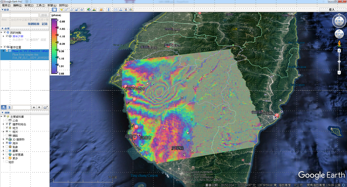
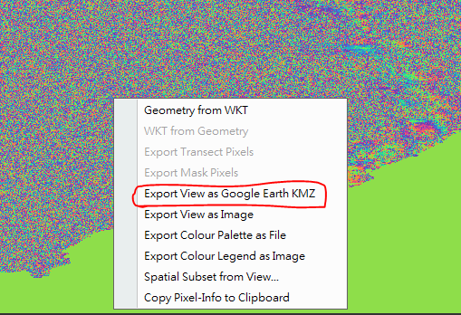
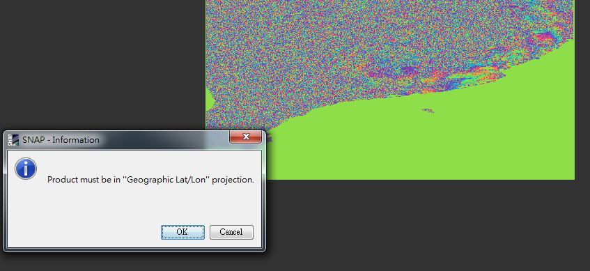
I am trying to “export view as google earth KMZ” for phase_igf_VV ,but get this information:product must be in “geographic Lat/Lon” projection.
Which steps have to be performed to make product be in Lat/Lon ?
thank you.
I am trying to “export view as google earth KMZ” for phase_igf_VV ,but get this information:product must be in “geographic Lat/Lon” projection.
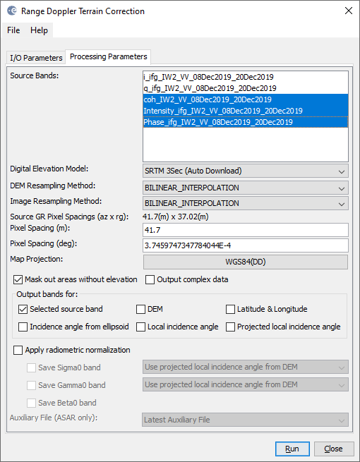
when you apply Range Doppler Terrain Correction, you select WGS84 Lat/Lon as output coordinate reference system. Afterwards, you can use the data for KMZ export to Google Earth.
Dear ABraun
Thank you for your reply.
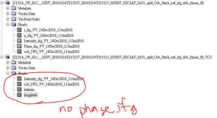
But I apply Range Doppler Terrain Correction,getting the result that there is no “phase_igf”.