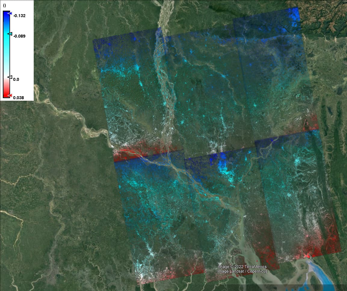
Hello! I am having a strange error with my phase displacement showing incorrect subsidence values. I processed two images (names provided below) and in their overlap, they have opposite data regarding subsidence. The northern image reports a positive change in displacement while the southern images report subsidence. In addition to this, the images seem both have the same trend in displacement with subsidence occurring in the north and displacement occurring in the south which is counter to on-ground data over the past thirty years.
I am following the tutorial from 2020 to the letter and can not theorize a way to fix this. If anyone knows what the error may be, I would be more than grateful for the solution. Also, I apologize if this has already been asked but I did not know how to properly describe the problem without illustrating it.
Windows
SNAP Version: latest
RAM: 32Gb
Steps: Split->Apply Orbit File-> Back geocoding-> ESD-> Interferogram-> Deburst-> Phase Removal-> Multilook-> Goldstein Phase Filtering-> Snaphu Export-> Snaphu Unwrapping (external via command line)-> Snaphu Import-> phase to displacement-> Terrain Correction (for displaced and pre export image) → create stack for two terain corrected images-> Band maths coherence masking-> export to kmz
Images
S1A_IW_SLC__1SDV_20220128T120456_20220128T120523_041661_04F4D6_A04F-SLC
S1A_IW_SLC__1SDV_20220116T120457_20220116T120524_041486_04EEE8_107A-SLC
S1A_IW_SLC__1SDV_20220128T120432_20220128T120459_041661_04F4D6_FD73-SLC
S1A_IW_SLC__1SDV_20220116T120432_20220116T120459_041486_04EEE8_B5FC-SLC