Hello evrey one,
i try to open landsat oli imagery in Snap. this image (on demande) from earth explorer site and in reflectance mode. i try to change the name of the folder and the bands and metadata file but i still cant open it. i realy need your advises and help.
What Landsat product exactly?
Opening the MTL file should work. Something like: LC08_L1TP_172062_20150728_20170406_01_T1_MTL.txt
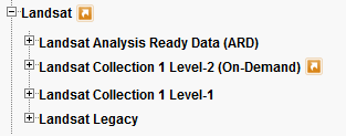
Hey, i used the product: landsat collection level-2 (on demand) it should be in reflectance surface.
and its works for landsat collection 1 level-1 its easy to open with MTL file.
I just placed an order to test it and will report as soon as I have the data.
thank you for the help.
I received the order and can confirm that none of the imports is able to open Landsat Collection Level-2 products:
Open > Select MTL
Import > Optical > Landsat > Landsat 8 (15m) > Select MTL
Import > Optical > Landsat > Landsat 8 (30m) > Select MTL
Import > Optical > Landsat > Landsat > Select MTL

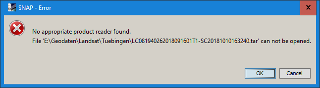
Open > Select tar file
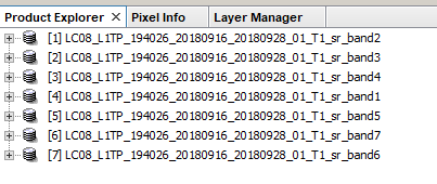
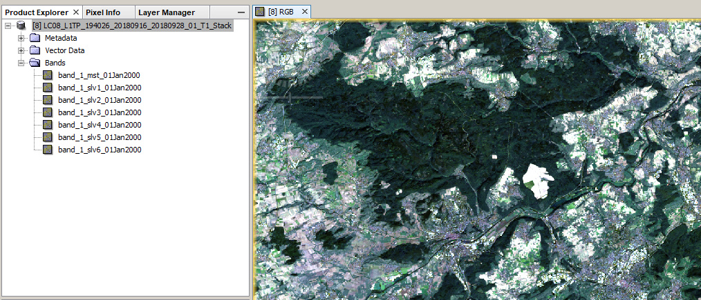
You can, as a work-around, simply select Open and select all TIF files
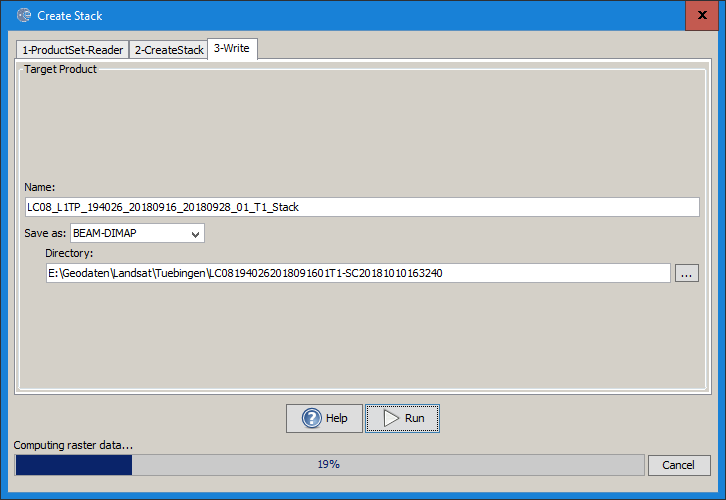
Then create a stack:

Select “Product Geolocation” here as Landsat doesn’t have Orbit files

The result:
If you need them, you can edit the band names and wavelengths/bandwithds under the properties of each bands and save again.
https://landsat.usgs.gov/what-are-band-designations-landsat-satellites


Hello thank you for the help i did follow this steps but the problem here that snap can’t read the image in reflectance values anymore and the image become in DN values.
that is true, yes. Makes downloading the calibrated values quite senseless…
My understanding is that SNAP is almost exclusively made for Sentinel imagery. I don’t know exactly what you want to do with your Landsat images, but I would suggest you open them with a program such as SAGA. It’s open source, free, and has plenty of tools :
information at http://www.saga-gis.org/en/index.html
download at https://sourceforge.net/projects/saga-gis/files/ (current version: 7.0.0)
That is not correct, SNAP supports numerous 3rd party non-Sentinel missions already and will also support different Landsat8 products. @obarrilero
OK. Thanks for the info
Thanks for the recommendation i usually work with ENVI, in my thesis i am supposed to use the both images : sentinel 2 and landsat , so for ENVI it cant suport sentinel and learn the metadata file and snap can learn the metadata file of landsat 8 level c ( toa radiance) and cant open the metadata file of landsat 8 level 2a (toa radiance).
I wish SNAP can support landsat reflectance surface soon
you can still convert DN to reflectance yourself within snap using simple band maths.
Yes and that’s the only solution that i have.