your raster file is over 1 gigabyte of size. Depending on the number of tiles, the number of processors and the overlap you selected, this can take a considerable time. So if there is progress during the unwrapping, all you can do is wait, reduce the raster size before unwrapping (multi-looking or subset) or switch to a faster PC.
1 Like
Currently I do not have access to SAR data besides Sentinel 1 images; but if I may ask, what if I try creating an interferogram using X-band or L-band-based images? Would the change in the wavelength possibly affect the interferogram patterns?
Larger wavelengths interact with different surfaces and are less prone to temporal decorrelation. I can’t promise that it will look better. There is probably too much vegetation in your area, which is always bad for InSAR.
Thank you so much.
I can confirm that there’s vegetation in some areas covered by those interferogram examples shown above, however their extension is very limited as the area west of the gulf is mostly arid rocky desert with occasional flash floods.
But I am interested to know your opinion of how an interferogram would look like if there was no ground motions whatsoever in between the two dates of the SLC pairs
In other words, How can I make a judgment whether the interferogram quality reflects no ground changes, processing error, atmospheric disturbances or temporal decorrelation?
Would clipping the image before the interferogram creation step make any difference in the interference patterns?
I have tried sub-setting after co-registration then I have received this error while creating the interferogram from the subset product
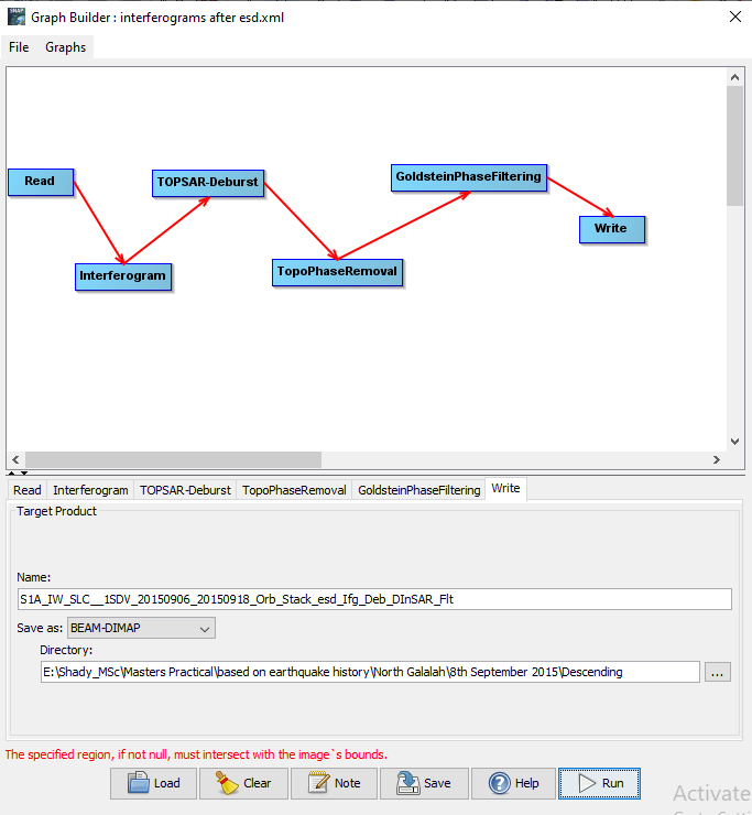
doesn’t make sense to me that the subset of the stack won’t work. Did you save it as BEAM DIMAP?
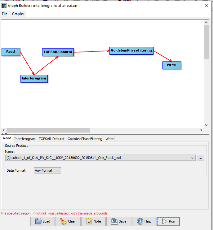
You can skip the topo phase removal and directly perform this during the interferogram formation step.
Yes, I did
I already skipped it and also tried the same process on another subset from a different stack image and yet the same error popped up
Hello I am beginner at InSAR
I have a question about SNAPHU. When I run below command :
snaphu ddiff.adf.adf_pha.geo.nn -c ddiff.adf.adf.cc.geo.nn -o ddiff.adf.adf.geo.unw 3867 -f config_snaphu
I take this error:
snaphu v2.0.3b0.0.1
9 parameters input from file config_snaphu (10 lines total)
Reading wrapped phase from file ddiff.adf.adf_pha.geo.nn
No weight file specified. Assuming uniform weights
Reading correlation data from file ddiff.adf.adf.cc.geo.nn
File ddiff.adf.adf.cc.geo.nn wrong size (2347x3867 array expected)
Abort
When I geocode interferogram and cc, they become same size (70M)
I hope this is the best thread to ask. Is this folder (Snaphu_tiles_----) needed after Snaphu Import? It takes up significant space
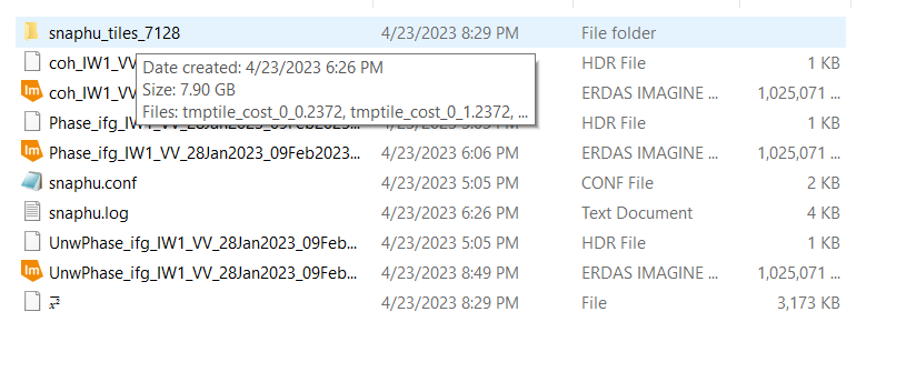
no, you can delete it after successful import.
Like this?
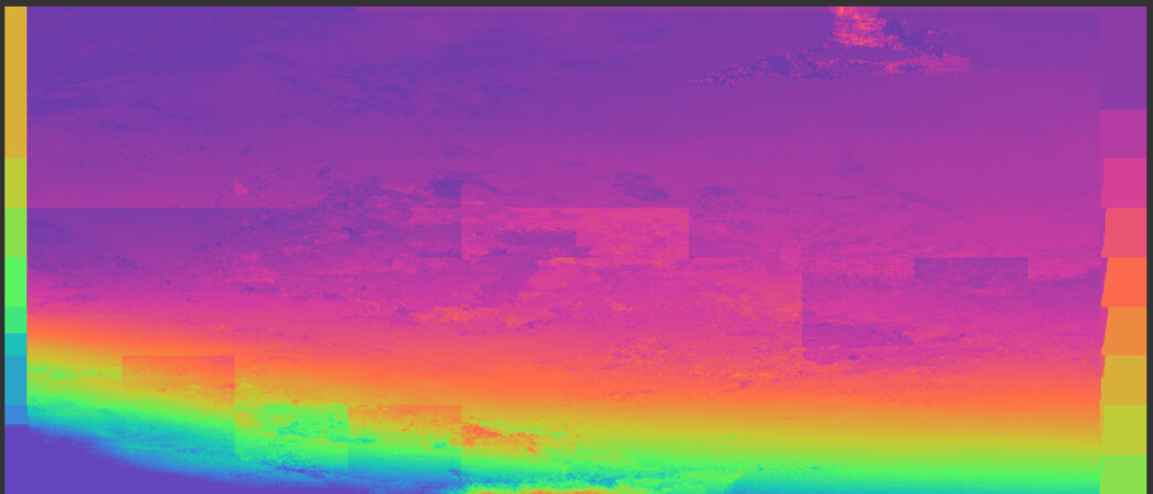
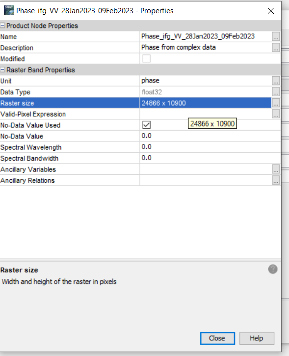
In my case, this is the raster size
Setting tiles of rows and column 10x10 with overlap size 200x200 created this unwrapped phase pattern
Why multilooking isn’t recommended in case of having very high fringe rate ?
Hi, you may try these three methods to get solution-
- Check System Resources: Verify if your system resources are being fully utilized during the unwrapping process. You may want to close unnecessary applications and ensure that SNAPHU is using all available CPU and RAM.
- Optimize SNAPHU: Ensure you are using the most efficient settings for SNAPHU. You can refer to the SNAPHU documentation for optimization tips.
- Consider Windows Alternatives: If SNAPHU continues to be slow, you can try using a Windows alternative like GAMMA software or ISCE (InSAR Scientific Computing Environment). Both of these tools can unwrap interferometric phases and might offer better performance.
Thanks
See the explanation in this short video lesson: https://m.youtube.com/watch?v=kebvF_QYB8E You can try all the steps in PyGMTSAR (Python InSAR) software available on GitHub: GitHub - AlexeyPechnikov/pygmtsar: PyGMTSAR (Python InSAR): Powerful and Accessible Satellite Interferometry
SNAPHU allows tile unwrapping when the large grid splits to a tiles greatly reducing RAM and processor power consumption. Of course, the solution is not global in this case and we need to check the unwrapped tiles phase consistency. See this interactive Jupyter notebook on Google Colab when we process and unwrap 3 stitched Sentinel-1 scenes and all the subswaths: Google Colab Yes, even on very limited Google Colab environment SNAPHU can unwrap large grids. By the way, always check SNAPHU output when some suggestions about the best processing parameters might be printed.
Please help me understand something.
I apologize for my limited English, but I would like to ask for your assistance.
I performed “SNAPHU unwrapping” on interferometric analysis results and obtained the results of “unwrapping.”
To make these results more readable, I conducted “Radar > Interferometric > Product > Phase to Displacement.”
Is it correct to assume that positive values indicate movement away from the Line of Sight (LOS) of the satellite, while negative values indicate movement towards the LOS of the satellite?
Thank you.
just search through the forum regarding your key words ,it has been answered many times.
Does someone know how to fix this unwrapping error where the supposedly masked water area gets unwrapped as well? The water areas were masked before the snaphu exporting. Shown in the table on the left side of the image is that the water area has a displacement even though it shouldn’t have one. This is what confuses me, whether the water area had an effect to the unwrapping.
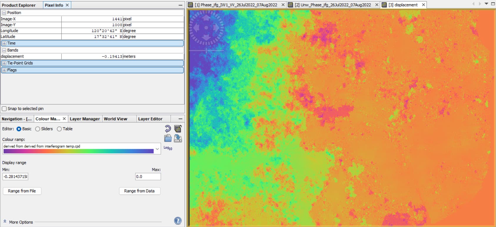
If this will not affect the result, does the displacement result has a meaning or not? I was thinking there is an error because the epicenter of the earthquake is from the northwest of the image, but the displacement map shows that there is less ground displacement the closer I get to the center.
1 Like
Dear Sir
Impressive work, congratulations.
I want to ask you, do you compared your altitude with the actual altitude.
And what accuracy have you achieved?
Thanks