Hello,
I am new to image interpretation and processing with SNAP so my question may be basic but I didn’t find the answer in existing topics.
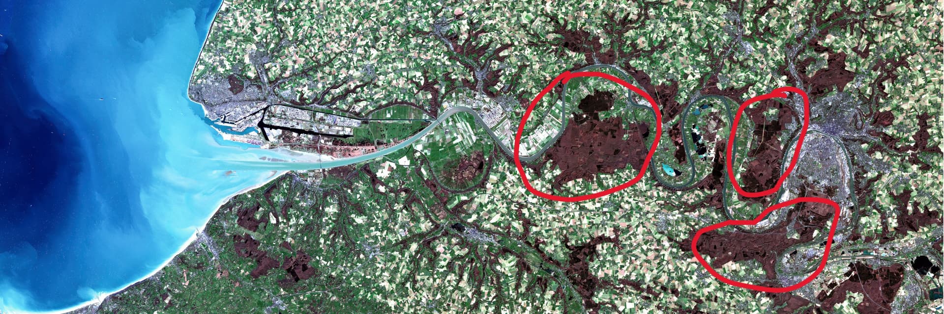
I opened a Sentinel-2 product in SNAP, then calculated the RVB image using the default Natural Colours profile (using Bands 4, 3 and 2 for Red, Green and Blue) and I got the following result. My question is : why are there red-coloured areas on the land ? These areas seem to be vegetation but what do they represent differently than other vegetation areas nearby ?
Hi @vuduciel Maxime,
this scene was probably acquired in winter, and what you circled are broadleaf forests withouts leaves, which are grey / brown in natural colours. Depending on the adaptation you used to have this nice blue colour on the sea, you might have given this reddish colour to these forests. Just before spring, the buds (bourgeons) can also give a reddish tint naturally.
Olivier