Please How to view the Spatial resolution of the pixel in SNAP ? I’m a new Snap user.
generally, this information is written somewhere in the metadata, but its exact location depends on the data you are using?
What product are you working with?
I use Sentinel 2 L2A which I obtained after correction of Sentinel L1C
This page describes the spatial resolution of each band
https://earth.esa.int/web/sentinel/user-guides/sentinel-2-msi/resolutions/spatial
http://www.gdal.org/frmt_sentinel2.html
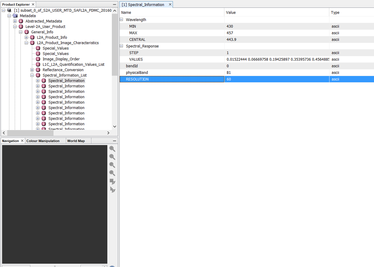
I am currently not on a computer with S2 images, but there should be also the metadata information on each band somewhere. You can search the metadata for names and values by right-clicking on it.
Edit:
2 Likes
Thank you very much Your help is very precious.
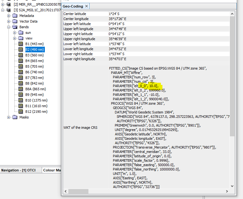
Another place, more general, but also not always available is the Geo-coding information window. Only for projected scenes.
At Analysis -> Geo-Coding or the Phi-Lambda ![]() icon in the menu bar.
icon in the menu bar.
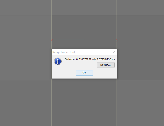
Or you can measure it. Zoom in into the image that you have big pixels and then use the Range Finder Tool ![]()
1 Like
one question, you choose [elt_0_0,10], so why you did not chose [elt_0_2 or [elt_1_1 or others?
Thanks in advance.
The elt__ values are values of the matrix of the affine transformation which defines the UTM projection in this case.
elt_0_0 is the scaling in x direction and elt_1_1 tis the scaling in y direction.
You can check this wikipedia article: https://en.wikipedia.org/wiki/Affine_transformation#Image_transformation
1 Like