Hello,
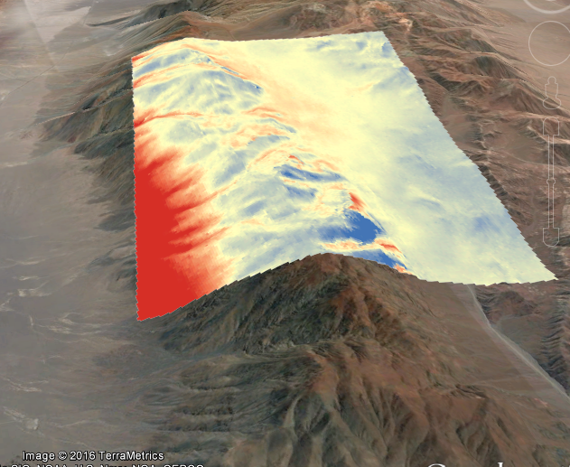
Does anyone know that SRTM is a rigth or left looking system. Because I created a difference map from s1 and srtm dems for atacama (high-pitched hills) and there is visible that main differences red (positive) and blue (negative) are on slopes. And besides these, SRTM is also have a geometric disortion
., isn’t it? thanks