SNAP Feedback
STEP Forum
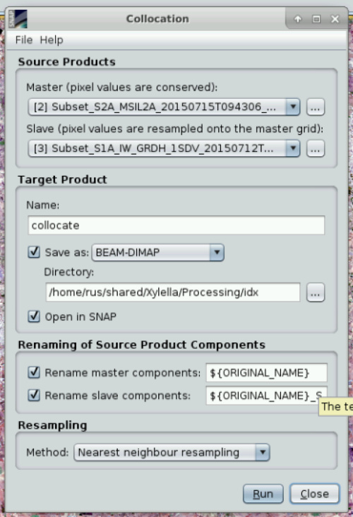
Stack or Collocation
snap
wincenzo
November 28, 2019, 2:23pm
14
@marpet
i just solved by removing “_M” from the collocation
rename master components
setting
immagine.jpg
500×732 107 KB
1 Like
Cloud mask - SNAP sentinel 2
show post in topic