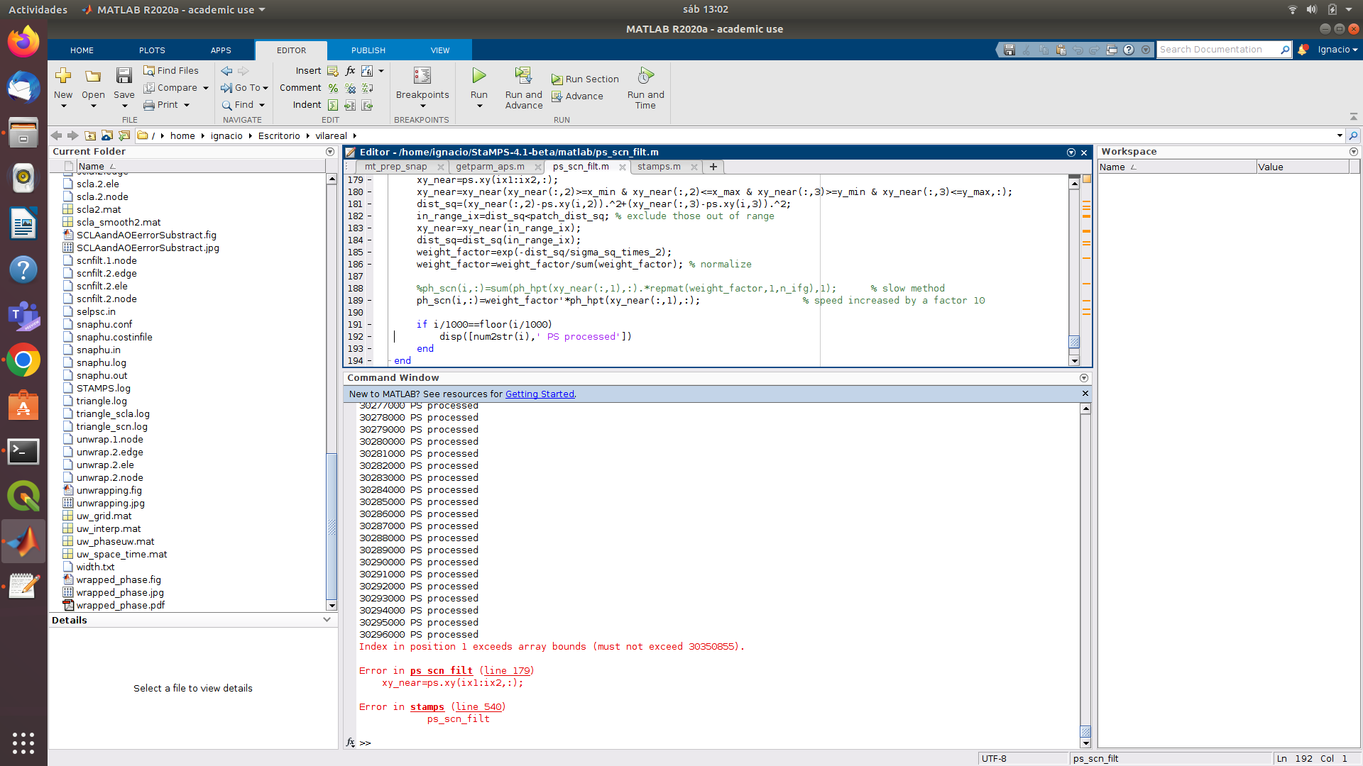
Yes, I did check using the getparm option. The value changes for the top folder but when I use getparm in individual patches, the value remains to be unchanged.
This is a major confusion now.
I have my following images after and before unwrapping.
I changed my reference latitude and longitude in the stamps, but still the whole area displays.
The limits in the x and y axis change but the figure shows the complete area.
you can only use the a flag (in “v-toa”) if you have performed atmospheric correction using TRAIN or GACOS. If this is not the case, you can only plot “v-to”.
Not sure what you did… but if you run StaMPS within the INSAR_XXXXX folder, it takes cares all the subfolders and so on.
Probably you run step 5 or so within the PATCH folder, which lead to the issue you reported.
Happy to see that you solved it. This is the best part of it.
Enjoy StaMPS
And in some patches, very few pixels were initially selected, leaving nothing after the weeding step. Should I increase the selection density and repeat the whole process "stamps(1,4) for all patches? or only re-do steps 3 and 4 so that the files 2.mat files will be overwritten?
I appreciate it. what if some of the patches have interferograms already initially deficit of pixels because the area they represent is pre-dominant by water body
There will rarely ever be any ps pixels left for weeding. Shall I continue processing and ignore those areas? or must I try the best to subset away water bodies during the pre-processing ?
After merging Is it possible to view the patch gird with each’s number on the merged scene in order to identify why some patches are devoid of PS during weeding ?
like this
I have a water body in my study area and it’s what most likely causing a particular patch to have no PS points left after steps 2,3.
Also, will continuing merging this PS-lacking patch cause problems in further processing, or may I leave it as is?