Hi!
I am using STaMPS since a few weeks now, and have set up a test case to get some experience with the processing flow and functionalities within STaMPS. I have chosen an Island in the Netherlands (Marken Island), to see whether it is possible to estimate some deformation time series on the dike surrounding the island. I have got some nice results, but still have a couple of questions regarding the processing.
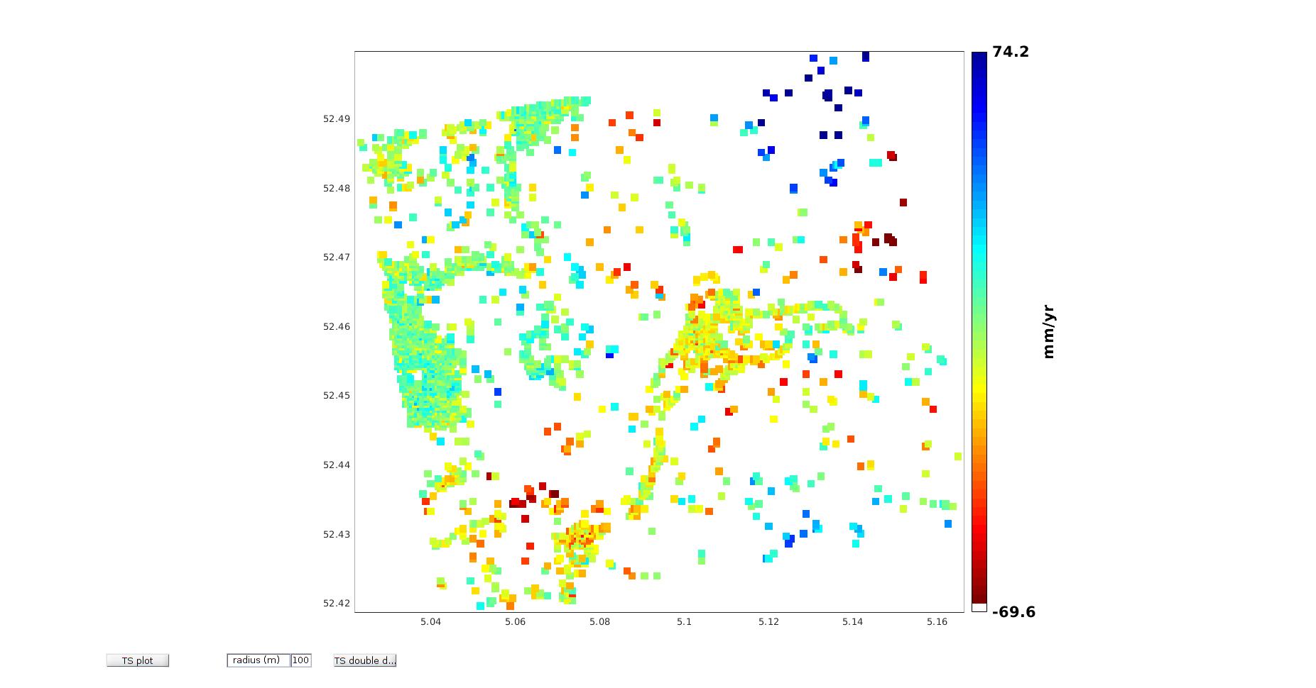
- There are a lot of PS selected on the water. Why are these pixels selected as PS? And is it possible to include a mask to exclude these pixels from the processing? I also see some PS close to the dike which are on the edge of the water boundary and the dike. What is the accuracy of the georeferencing process of STaMPS?
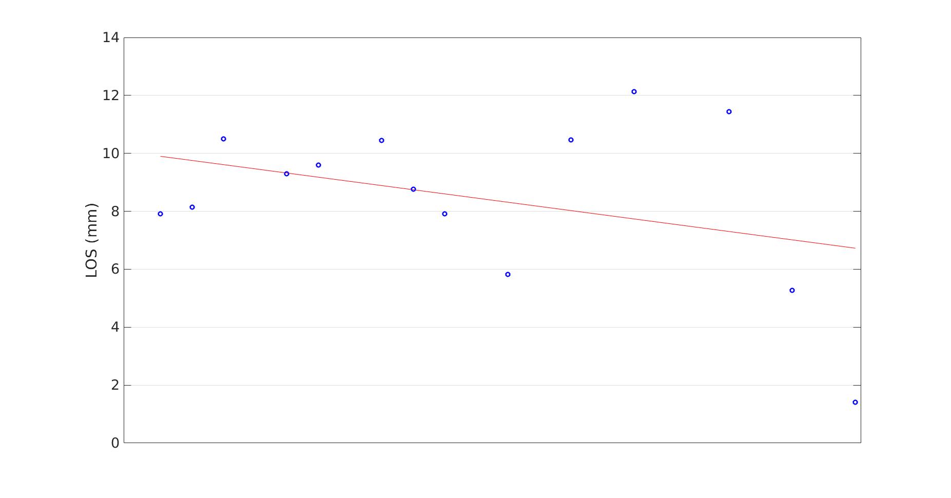
- If I look at a LOS displacement of a PS, how do I know the point to which this deformation is related? Is there a reference point to which the deformation is related and how do I know where this point is?
Hopefully you will be able to answer (some of) my questions 
Kind regards,
Joost