Hi everyone,
I have been trying to use s1tbx to generate coherence maps over different regions. Almost every time I try to do this, I get strange artifacts in my final coherence maps. I will include some general screenshots below and then focus in on a specific case. Most of the time, they have large stripes of no data in somewhat random orientations.
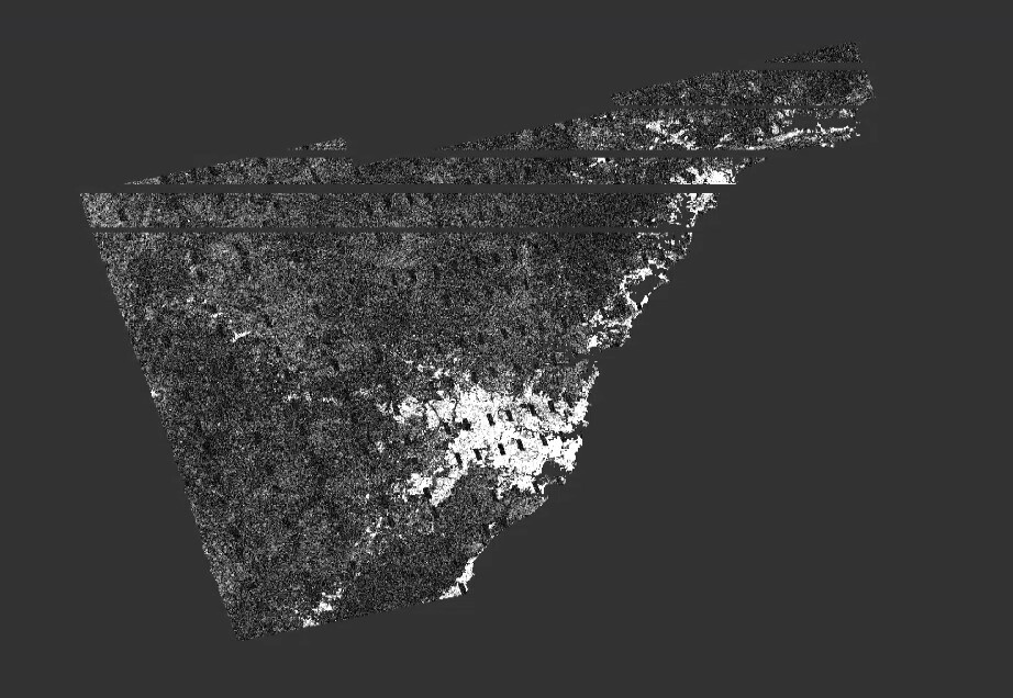
Here’s an example of one over Vadodara, India with a lot of stripes and some odd bands in the leftmost swath:

Another odd one over Sydney recently:
I process most of these with a bash script I wrote. However, for the case I want to focus on, I processed the image in the SNAP GUI to eliminate any error that may be coming from my script. This will be a coherence map over two Vadodara scenes:
- S1A_IW_SLC__1SDV_20200602T010224_20200602T010251_032831_03CD82_0CDA
- S1A_IW_SLC__1SDV_20200614T010225_20200614T010252_033006_03D2B4_1D9D
I did not use the graph tool to process this, but here is the graph of my processing to get an idea of my processing steps:
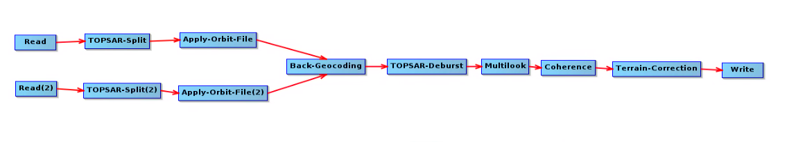
Instead of processing this with the graph tool, I clicked through all the menus in the GUI and manually set the parameters. I split subswath 2 and only processed VH. For multilooking, I used 7 range looks and 1 azimuth look. For Back-Geocoding, I used SRTM 3Sec (Auto Download) for my DEM. For my orbit file, I used Sentinel Precise (Auto Download). Other than that, I believe I used the default parameters.
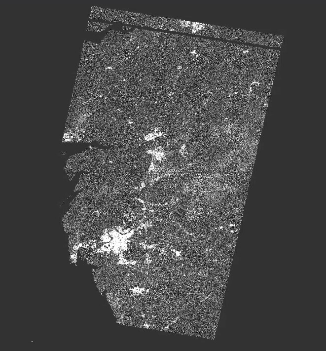
Now, there is something a little strange about my situation. I am trying to process these on a lab machine with RHEL 7.7 and 32GB RAM. Since this OS doesn’t have GLIBC_2.23, I had to do some of the processing in a docker image with Ubuntu 20.04 as a work-around. For this case, I had to run Back-Geocoding and Coherence in a docker image using command line.
Anyways, here is my final result. You can see there is a stripe artifact at the top:
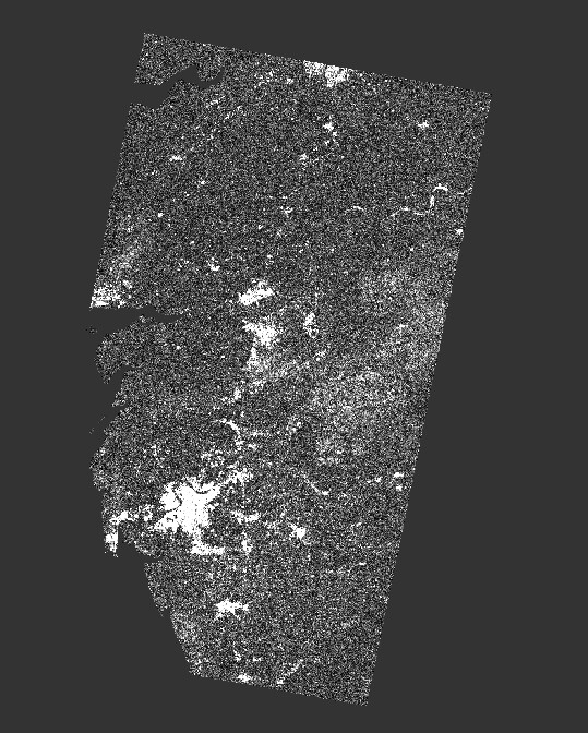
I ran the same processing steps (all with GUI, no docker) on my own computer with Ubuntu 20.04, 16GB RAM and did not get that artifact. Here is that:
Any idea of what I may be doing wrong? Let me know if you have any thoughts or questions!
Thanks