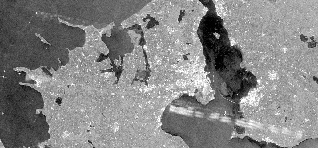
I noticed that many images over Denmark have a persistent stripe south of Copenhagen and another weaker one northeast of it. The image below is from VV in S1A_EW_GRDM_1SDH_20160121T053200_20160121T053252_009588_00DF3F_5CA9, but you can see a stripe in the same place, eg, in S1A_EW_GRDM_1SDH_20151228T053201_20151228T053252_009238_00D52E_325A and S1A_EW_GRDM_1SDH_20160116T052412_20160116T052453_009515_00DD0C_FAD9.
Is this due to some strong radio interference? I don’t suppose there are ways of removing it in toolbox processing?
Yes stripes are due to radio frequency interference (RFI) from the ground. Although it can be removed in the processing from raw data (Level 0) to image data (Level 1), this is not performed by the Sentinel-1 Instrument Processing Facility (IPF). It cannot be removed from the processed Level 1 image such as the one you show.
This can also be caused by interference from other C-band SARs like Radarsat-2. This should be flagged somehow by the IPF. Can anyone think of a good way to detect this? Currently I need to scan through the quicklooks and delete any products with bad interference.
This particular example is RFI from the ground. It is true that there can be mutual RFI between Radarsat-2 and Sentinel1-A as the local solar time crossing times are almost identical (18:00 at the ascending node) and Radarsat-2 has a 24 day repeat period and Sentinel1-A has a 12 day repeat period.
The two types of RFI can be distinguished by their duration. For RFI from the ground usually only occurs over a few km in azimuth while the mutual RFI can last for a few minutes. Slides 28 and 29 of the presentation at http://sarcv.ceos.org/documents/doc/156/ show examples of the two types of RFI.
Iveci, why do you feel it necessary to delete product of RFI, especially as the RFI only affects a relatively small part of the image?
Peter, nice presentation. I especially liked the examples of the trains.
I delete these when making mosaics. Although for RFI from the ground it may be possible that the interference is usually there over that area.
The main impact of interference removal is the additional time to processor the L1 data (e.g. each range line would need to be checked for interference). Also it is currently thought that only a small percentage (<1%) of products are affected by interference. If the interference problem is found to be worse than currently thought then its removal will be considered for inclusion in the S1-A SAR processor.
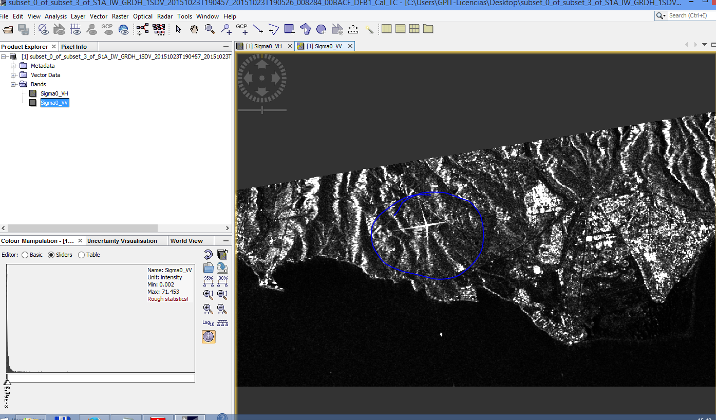
Sorry, I ve been reading all you have written and also the info that Peter Meadows have shared. My question is that I ve been studying Sentinel 1 images for academic purposes and I ve seen many times strange brights along a few images. Brights as “stars”. For example in this image of south Gran Canaria (Canary Islands) there is an strange bright… is it a corner reflector or what?
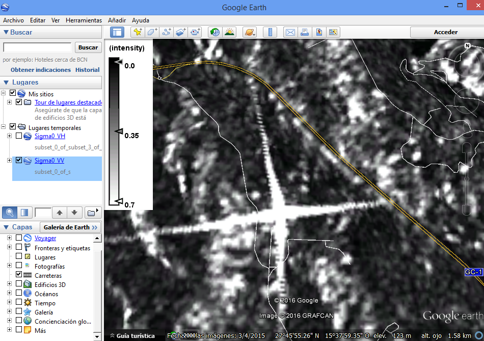
This bright object (referred to as a point target) is actually the ESA ground station at Maspalomas - see http://www.esa.int/Our_Activities/Operations/Estrack/Maspalomas_station for more information. You can also see it in Google Earth - zoon in at lat 27.763308, long -15.632540 deg.
Like many point targets, the response is quite different between polarisation combinations. A trihedral corner reflector point target (https://en.wikipedia.org/wiki/Corner_reflector ), for example, will only provide a response in HH or VV and not in HV or VH. This is the case here. To get the response in the S1-A image, one of the ground station dishes must have been pointing at the satellite (and most likely downloading data) at the time of acquisition.
Thank you very much for your quick answer. Im just surprised about the ground station at Maspalomas. I live here in Gran Canaria and I have even been there (many years ago) as a student visitor. I dont know how I didnt think about it! Yes, that´s the location, Maspalomas! Anyway, I had to confirm it. I can understand and imagine that this is the record of the reflection of ground station antennas and structures. It´s very useful to know the cause of this bright.
Thank you very much again for your unvaluable help and for solving my doubts.
I have checked with Google Earth files on KMZ…! It´s the Maspalomas Ground Station. It´s perfect. Since now and then I will check on optical images before (such as Google Earth) to see what´s in there. Also for whoever who read this post.
Could you please explain a bit more about why the trihedral corner reflector would only provide response to co-polarizations? (being visible in VV/HH/ images?)
I think that is due to the fact that a specular surface (even 3 of them in the trihedral reflector case) does not change the emitted polarization. So co-pol gonna back intensely while cross-pol not.