@junlu, we followed your advise in the aforementioned post about using the Update Geo Ref (Ouput processed results with only coordinates terrain corrected).
However, we encounter the issue as outlined in this specific post. This seems to be a bug. Do you have an idea what could be causing this?
Furthermore, when the “subset” is applied separately the updated latitudes and longitudes resulting from the “Update Geo Ref” are not used. The original latitudes and longitudes are used and these seem to be translated to the new latitudes and longitudes.
As an example I include here an image of the square (white) image over which we take the subset, and the resulting subset region (red):
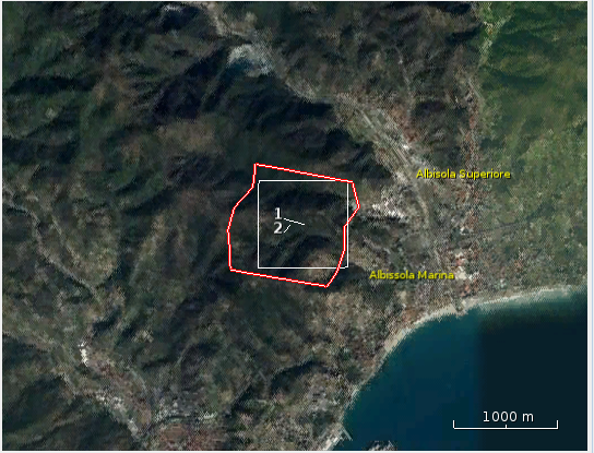
I am not sure what this is caused by. I was thinking this might have to do with the fact that latitude and longitude are specified in the “Tie-Point-Grids” and are not updated after using “Update Geo Ref”.
Might you have any suggestions? I appreciate the effort. Thank you.