I would like to subset the same area for both ascending and descending pass over my test area. However, the corner coordinates employed for one pass does not subset the same area for the other pass. I notice that it only keeps the upper left and the lower right corner anchored and of course some common area but not an exact overlap. What should be an optimal way to slice out the same areal extent for different passes. Here is a snapshot,
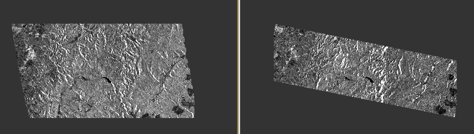
You could terrain correct both images, stack them and select minimum as output extent.
@ABraun
I am trying to Create Stack with several S1 terrain corrected scenes from both ascending and descending passes with,
Resampling type: Nearest Neighbour
Initial Offset Method: Orbit
Output Extent: Minimum
Selected the Master using: Find Optimal Master
But the process is unable to write the product file. Where am I going wrong?
I must also mention that these are full swath terrain corrected S1 images.
This seems to be working only for a pair in my case and not more than 2 scenes.
after terrain correction your data is already geocoded - try “Geolocation” instead.
But is there a limitation on the number of images one can stack since in my case it only worked for a pair or is it just limited by the available memory?
the BEAM DIMAP format stores the rasters of a stacked product as separate img files in the data folder, so there is no upper limit.
Can you please explain the difference between the outcome obtained by these two methods?
which methods exactly do you mean?
The Initial offset method by,
-Orbit
-Geolocation
one is intended for complex radar products in slant geometry which contain orbit information in their metadata, the other can be applied to any raster which is already geocoded (e.g. by range doppler terrain correction).
Can you also give some insights on the Output Extents and the Resampling Type that goes with the Initial Offset method and the function of the tab titled ‘Find Optimal Master’ in the CreateStack window. For example,
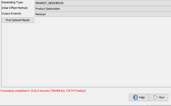
For stacking two terrain corrected products from different passes (Asc & Des) I selected,
-Resampling Type: Nearest Neighbour
-Initial Offset Method: Product Geolocation
-Output Extents: Minimum
So I am curious to know what other combination was possible and how would the outcome vary.
you need a form of resampling because you have images of different tracks. Nearest neighbor is fine to preserve fine features, but if you want to look at larger areas, you can as well use bilinear resampling which has a more smoothing effect.
Minimum is the only output extent that makes sense because you can only use those areas which are covered by both images.
At the moment I am not subsetting the images from different passes before terrain correcting them to finally stack them and crop out the common area.
Is there a way to crop the common area before TC or one has to visually look at the image footprint and approximate the corner coordinates to crop the common area out before TC and finally stack them with Output Extent as Minimum?
good question. I am not aware of any method (in SNAP) to estimate the common area at earlier stages of processing, sorry.
It would have been nice to have a method to do so since it is taking horrendously long to stack two full swath images with the previously mentioned settings.