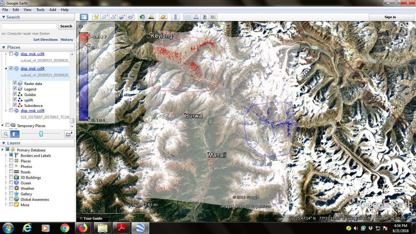
One another area results are here. DInSAR taking two images with 36 days temporal difference.
Shown subsidence and uplift.
Please help me to understand the phenomenon.
Subsidence is at uphill and uplift if in the bottom of hills. Is it due to the fact that snow from top has melted and accumulated at the bottom? Snow starts melting from April to August each year. (Images taken in the month of may and June)