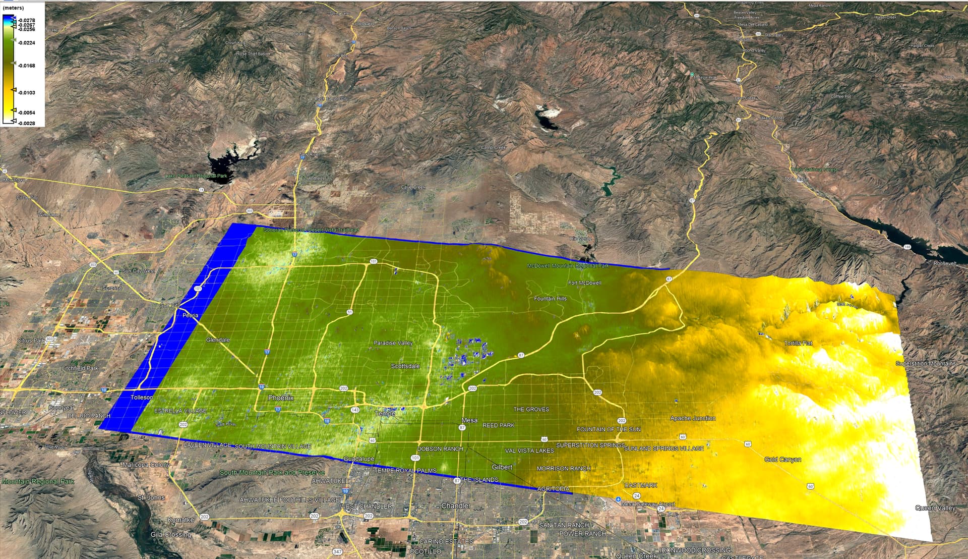
I’m trying (after a fairly long break of not using SNAP) to perform some DInSAR for the first time (following this guide), and I’m running into an issue where even though I’ve checked the option for removing topographic phase in the “Interferogram Formation” operator, once I go through unwrapping and converting to displacement, I still see a color gradient that somewhat matches the surrounding terrain (smaller features have been removed, but the larger scale is still here), but the scale is very small (i.e. the difference between the white and blue regions is on the order of millimeters, not meters)
Here’s an example of the data for a measurement in Phoenix:
This displacement would be Line-of-sight (LOS) displacement. To calculate for actual displacement, you would need either of the following:
Assuming you used a VV polarization, then you need the corresponding HH polarization on the same orbit to be able to calculate for actual displacement.
You can also use the incidence angle to estimate this. One way I do this is to output Incidence angle when correcting for Terrain (Range Doppler), that way a band of Incidence angles would be created and you can use the formula which is Vertical displacement = LOS displacement / cos(incidence angle) and this assumes that the horizontal (east-west) displacement is negligible compared to the vertical displacement.
So I did indeed use VV polarization here. This was done with Sentinel-1, so I don’t have an HH, polarization (at least here), only VV and VH. Can VH be used for this?
Do you know of a good guide on how to convert from LOS to actual using multiple polarizations?
VH can’t be used in this case. It is the corresponding HH that you need.
For the actual conversion using VV and HH, I do not have a written guide but I read a study that suggests estimating VV and HH out from LOS (Regardless of if the Polarization used for unwrapping was VV or HH)
Vertical displacement = LOS displacement / cos(incidence angle) and Horizontal displacement = LOS displacement / sin(incidence angle)
Then use the mean of both displacements as the actual displacement
Not sure how accurate this can be expect validated by several other studies or actual site measurement from a GNSS data or GPS data
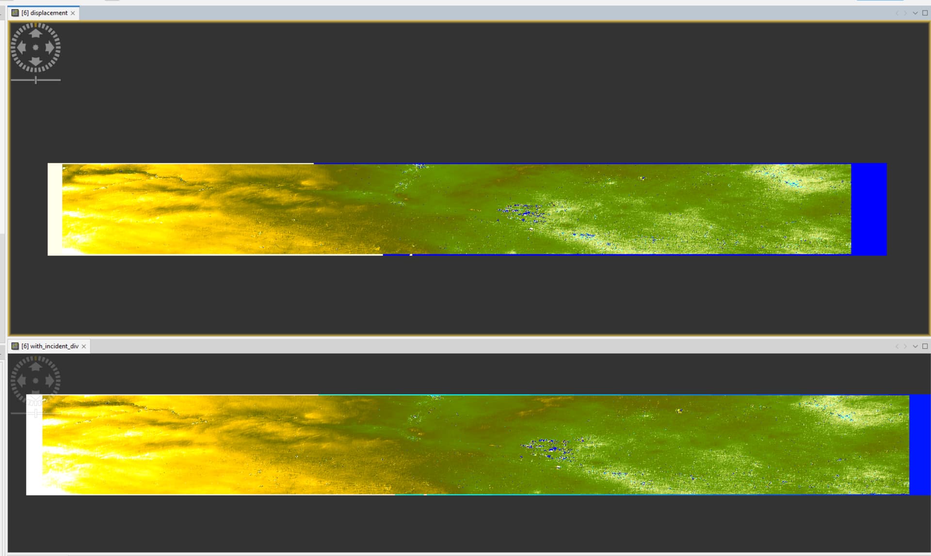
Ok. I’ve tried using the conversion as you suggested by using the “Band Maths” functionality to create a band with the equation displacement / cos(rad(incident_angle)), however, I’m still seeing this terrain and gradient issue as before.
The top image is the displacement, and the bottom image is the displacement divided by the cosine of the incident angle:
The remains of topography visible on your interferogram after topographic phase removal colud be relatated to the atmosphere. It is probably tropospheric stratification effect caused by changes in the water vapour content with altutude. There is number of paper describing it.