I am looking for suggestions on processing ERS-1/2 SAR IM Precision L1 Product [SAR_IMP_1P] to Sigma0.
Following are the steps that I currently applied:
Apply Orbit File
Radiometric Calibration
Range Doppler Terrain Correction
Not sure if I miss any important step?
My main concern is that should I apply Remove Antenna Pattern Operator before RD Terrain Correction?
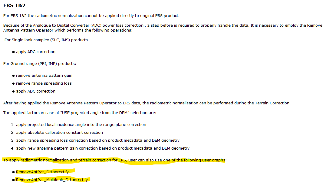
Besides, where can I find the two example XML graphs highlighted in yellow in the following figure (contents from SNAP Version 7.0.4 Help Contents for Range Doppler Terrain Correction):
I think your current work flow is fine. You don’t need to apply Remove Antenna Pattern operator before RD Terrain Correction because Calibration has taken care of everything. The two graphs mentioned in the help have been removed for some reason. The help should be updated. You can create your own graph if you want. I’d suggest you process the product step by step because sometimes it’s faster that way than processing with a graph
Regarding your suggestion on processing step by step faster than a graph, is it, in general, true for any kind of sensor’s data?
I just wonder the efficiency between different processing strategies:
Process step by step using SNAP GUI.
Process step by step using SNAP gpt (which will require “read” and “write” product for every gpt call).
Process with a graph.
Process step by step using snappy (which only needs one-time calling of “read” and “write” product).
My main concern is for Point 2~4 since I usually do bulk processing. Do you have any comment on this?