I have ALOS and ALOS-2 PALSAR FBD level 1.1 scenes that I need to terrain correct. The help on “SAR Simulation Terrain Correction Operator” points to a file giving information regarding products being supported. The file is available at:
It says that ALOS PALSAR FBD level 1.1 is not supported in terms of terrain correction. Is this file out of date?
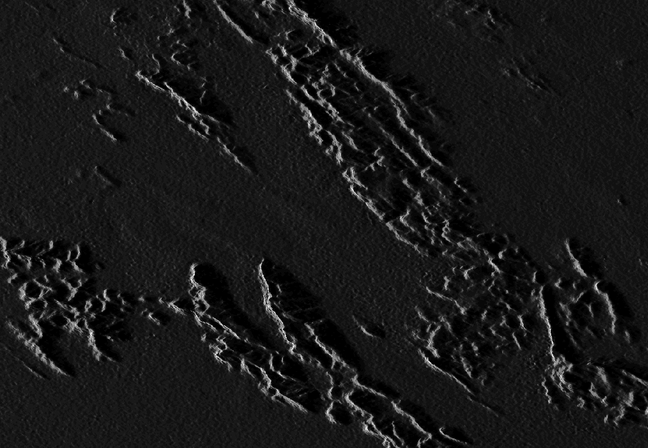
As a test I tried both the Range-Doppler and SAR-Simulation terrain correction approaches with an ALOS-2 FBD scene and I’m getting better results with the R-D method. Better results but still out by some pixels when compared with Landsat data. Has anyone experienced geolocation errors of this magnitude?
I think it is time to call attention on this post again.
I am working with ALOS-2 data at the moment and also tried to process the Range-Doppler- and the SAR-Sim-Terrain-Correction on my data.
Compared to other results processed with Gamma the TC-Results out of SNAP are worst expecially in foreshortening areas. Occurs this because of the insufficient support of ALOS-2-data or is the mentioned file out of date and there has to be another problem?
As a hint: The file is also linked in the integrated help file under “SAR Simulation Terrain Correction”, so up-to-dateness would be fine
Hi, I’d like to continue this conversation since I’m working with ALOS-2 1.1 data. I’m working on foreshortening and layover and any feedback I find is very useful. Are there any new updates to this topic?
Many thanks in advance!
I often worked with ALOS FBD 1.1 and never had problems with the terrain correction. But those were downloaded at ASF Vertex or JAXA.
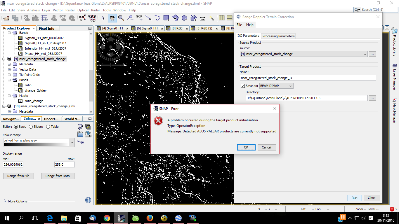
Did you download them from ESA? They currently only provide detected ALOS products.
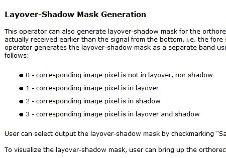
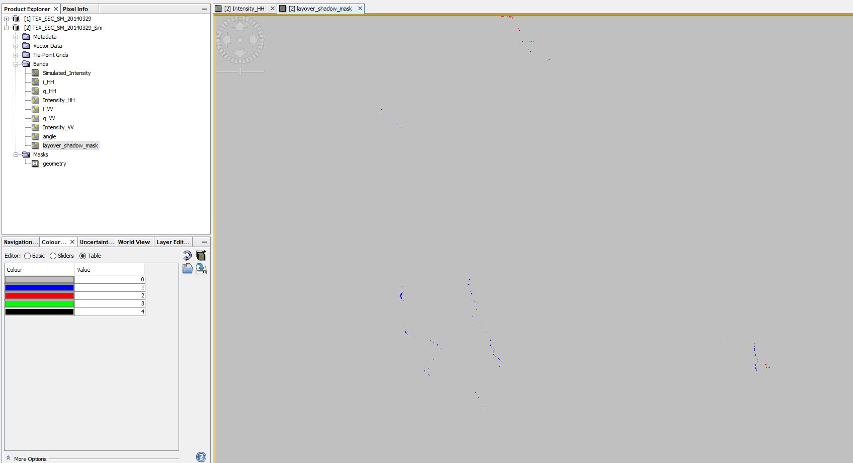
So far I haven’t had any trouble either in downloading the data. I am wondering, however, what the results really mean. The returned values do not come as separate masks (layover, foreshortening, shadow) and the values are not just 1, 0 or -1. Is there a tutorial that explains more of what is actually being processed? Many thanks.
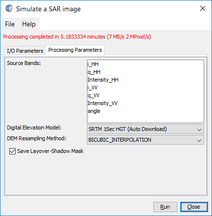
Thanks ABraun for the follow-up. Unfortunately, it doesn’t really. I have outputs where my values range from -0.25 - 1.75. Plus the output is only for the HH polarization. How would I get the output for the other polarizations?
Thank you ABraun. That was really helpful. I created my masks as you did. I think you’re right that what I was looking at was the back-scatter values rather than the mask values. So, how can I work with the data perhaps in a histogram, but not the back-scatter, as you mentioned?
I’m trying to understand what my results in the mask mean. If what I see in the histogram is back-scatter, then how do I link those values to the layover or shadow classification in the mask???
Any backscatter value under layover or shadow areas is not usable. It is interpolated during the Terrain Correction step b ut not a valid information because the signal did not reach those areas.
The mask simply helps you to estimate the severity of shadowing and layover effects in your image based on the DEM.
yes, I’d say so. Of course it could look different with a DEM of higher spatial resolution but it is at least a coarse estimate where in your image you need to be careful with quantitative information.