I have also not found an answer on the ESA Sentinel pages.
For question regarding the data, it is best to contact the Copernicus support:
eosupport@copernicus.esa.int
But I have reached out to someone at ESA. Maybe I can give you an answer soon.
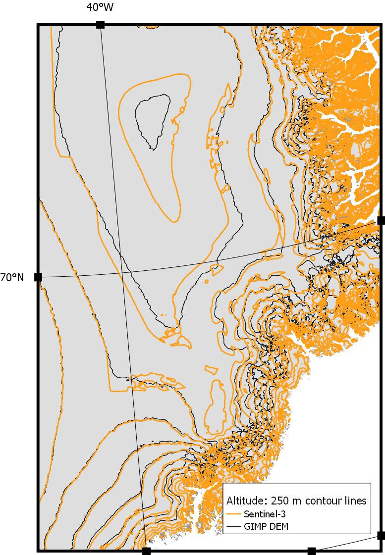
I was just informed that the Getasse30 DEM is used.
Probably this version, but I’m not sure. Maybe there was an update in between. AMORGOS: GETASSE DEM (esa.int)
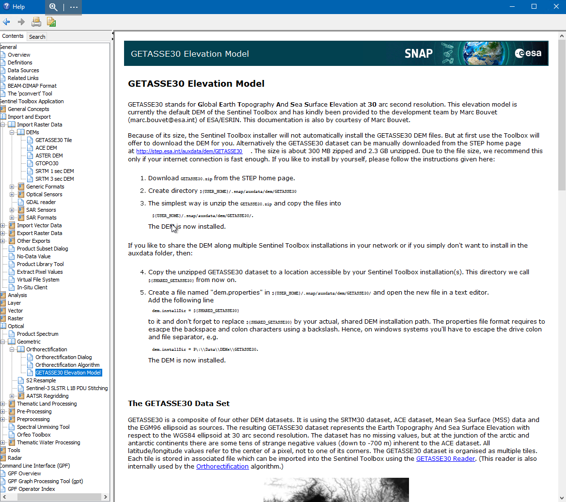
You can use it in SNAP too. But there we have made some slight improvements to it. Especially in reducing the amount of data. information about the DEM can be found in the SNAP Help.