I have clipped my DEM band (Raster>subset), and now I need to save it (Raster> Data Conversion). I am wondering what is the recommended Target Data type?
When I used unit16, all DEM values have been lost!
What data type has your original DEM band and what is the value range.
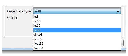
The selection depends on this information. But in general you should be on the safe side with float32.
Its Lidar DEM, geotiff. The range is 518.741-747.226 m elevation. After using the unit 16, all DEM values becomes double…
The only problem with floating is that Arc GIS accepts Int data type for converting raster to polygon. If I first use Int conversion, I will get the polygon, but I will lose some part of info.
It was just a Union test in Arc GIS although we have found a better data source for. And I won’t need to make that conversion. Regardless, saving the DEM in float32 is mostly recommended so.