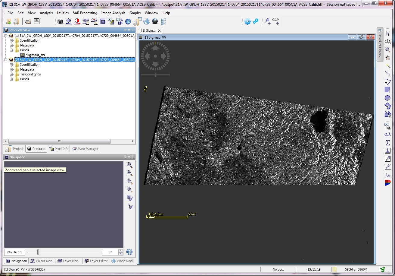
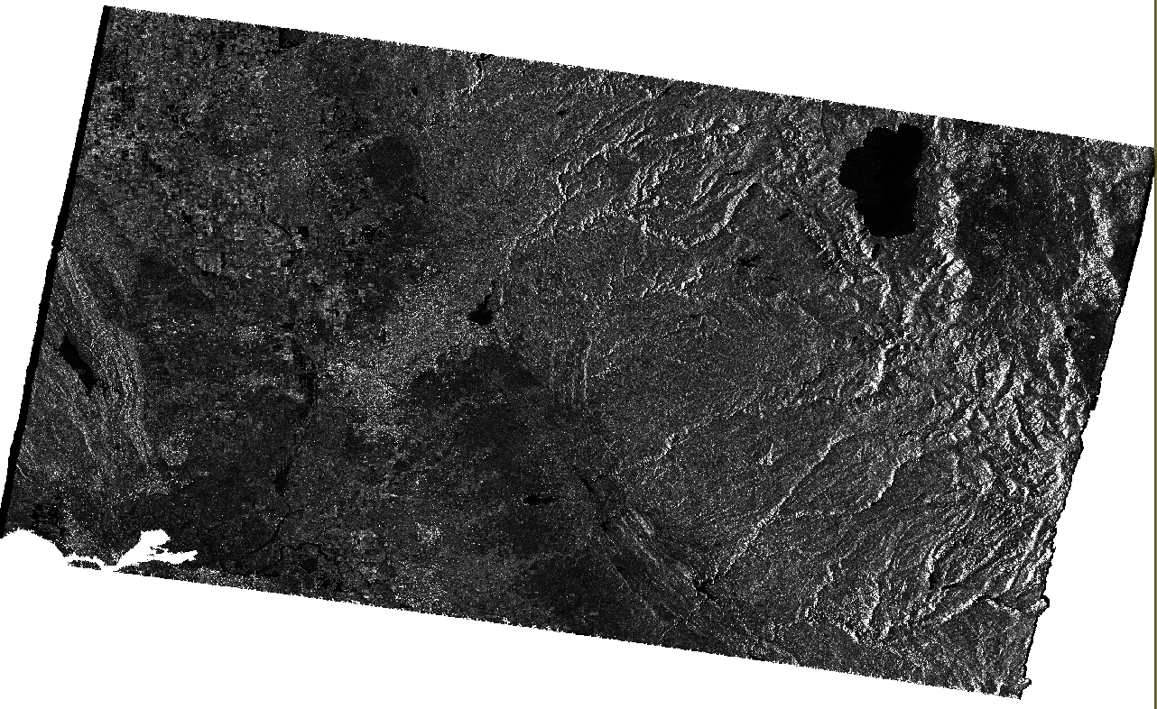
I am trying to calibrate Sentinel-1 data, and then run terrain correction to output sigma-naught as a GeoTIFF. Calibration (SAR Processing->Radiometric->Calibrate) appears to work fine, but when I Terrain Correct (SAR Processing->Geometric->Terrain Correction->Range-Doppler Terrain Correction) the output has the bottom portion missing like is shown here.
I have tried this using images S1A_IW_GRDH_1SSV_20150217T140704_20150217T140729_004664_005C1A_ACE9 and S1A_IW_GRDH_1SSV_20150301T140704_20150301T140729_004839_00605B_95A0. As the Calibration output shows the whole image I think I have the original data downloaded correctly.
The exact steps I’ve taken are as follows:
File -> Open Product -> select manifest.safe file
SAR Processing -> Radiometric -> Calibrate save as GeoTIFF or BEAM-DIMAP (I’ve tried both ways), and output sigma-naught
SAR Processing -> Geometric -> Terrain Correction -> Range-Doppler Terrain Correction save as GeoTIFF, deselect “Mask out areas without elevation”, leave all other defaults
I am using the Sentinel-1 Toolbox version 1.1.1 on a Windows 7 64-bit machine with 12GB RAM.
Has anyone else encounter this issue or know how to fix it? Restarting the S1 Toolbox software did not make a difference.
I didn’t have a problem using the latest SNAP 2.0 - calibrated and terrain corrected
After terrain correction, the image may be larger due to the map projection. In that older version it might not have been able to handle large tif files.
What exact commands did you use with SNAP 2.0? I’m having trouble finding the corresponding Calibrate and Terrain Correction commands. Or is there a way to open the Sentinel-1 Toolbox from within SNAP 2.0?
I figured out that I had an older version of the Sentinel-1 Toolbox installed (from PolSARPro), so I uninstalled and reinstalled SNAP 2.0 including the new S1 Toolbox. This solved my previous question about commands.
However now after I run the two steps using the pdated SNAP 2.0 I am still getting an error. When I go to open the final output GeoTIFF I get the error:
“Failed to open image view
java.lang.IndexOutOfBoundsException”
“java.lang.IndexOutOfBoundsException: pos < flushedPos!” is the start of the full error trace.
I think your GeoTIFF may be too big and going beyond its 32-bit index.
You will need to export as BigTiff.
That’s odd because it should give you an error telling you to use BigTiff.
Using the Principal Component Analysis operator I also got the error: ‘pos < flushedPos!’
I used a 2292 bands ENVI file as input, maybe the error is related to multi-band ENVI file, as reported in https://senbox.atlassian.net/browse/SNAP-502