In the Range Doppler TC module I never managed to specify the exact pixel spacing I want (15.0 m), the value keep on changing to 15.9 m. Also, in the end the terrain corrected images were far from being correctly geocoded when compared with Landsat data.
Has anyone followed the same approach (or similar) and found out the same problems?
With ALOS you should use the SARSimulation Terrain Correction
Also, I’m not sure if it would affect it but, you could try doing the
deskew before mulitlook.
Tried the SAR-Sim TC many times with different combinations of window sizes and I keep getting the same “java.lang.NullPointerException”.
The input is an ALOS PALSAR multitemporally filtered and coregistered stack of 9 FBD scenes that were previously calibrated, deskewed and multilooked (1 rg, 5 az).
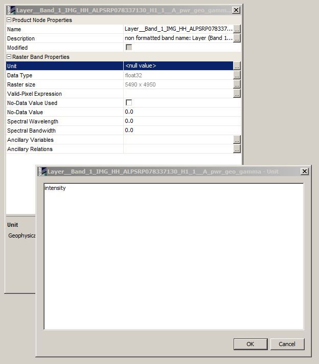
However, I managed to terrain correct my SAR data using another software and I wanted to apply a multitemporal filter. So, I have this BEAM-DIMAP stack with 18 terrain corrected bands and when applying the filter I get an error: “image requires a unit”. I tried to edit each image but it doesn’t update the field corresponding to the unit value.
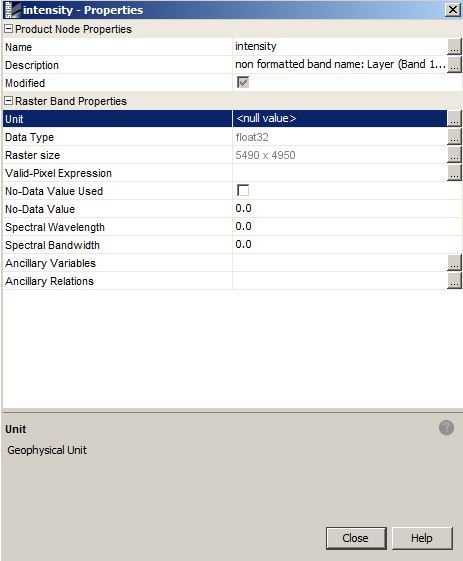
Thank you, the “Unit” field displays “null value”, but when I edit and change it to intensity the “Name” field changes to intensity and the “Unit” field remains as “null value”.
    Workaround:

    Open the *.dim file with any text editor and under:

    <Image_Interpretation>
            <Spectral_Band_Info>

    add a line between:
         <DATA_TYPE>float32</DATA_TYPE> and <SOLAR_FLUX>0.0</SOLAR_FLUX>

    called <PHYSICAL_UNIT>intensity</PHYSICAL_UNIT>
do the same for each band (BAND_INDEX) in your *.dim file. In this case my bands were saved as floating point and each band had “intensity” units.
Is there any way to preserve or create terrain corrected i, q rasters?
I would like to orthorectify and keep the complex image (i, q) in order to do some polarisation with the complex data in PolSARPro. I would rather have the complex imagery orthorectified.
But I also got this “java.lang.nullpointer” error while processing SarSim using i and q.
I suppose If it werent for the nullpoint error I would also get only Intensity.
Could you explain why is that? Why the real and imaginary part lost during orthorectification?
It is necessary to perform interpolation during orthorectification. Since the phase of a complex SAR image is random and noise-like, how should one perform such interpolation and would the end-result be valid?