Hi,
I’m running into issues running SNAP via command line using graph batch processing. I’m trying to terrain correct products that are radiometrically terrain flattened, and it looks like there is an issue with the product reader (I’m using only Sentinel-1 data but it keeps on mentioning the RISAT product reader), and mentions the absence of a DEM in creating the layover/shadow mask. I’ll copy and paste below both the xml graph I’m calling with gpt, as well as the errors I’m receiving. Anybody know how to troubleshoot this?
My processing workflow (for Sentinel-1 GRD high res dual pol images) is:
Apply orbit file → Thermal noise removal > GRD border removal > calibrate to beta nought > multi-look > speckle filter > rtf (using Copernicus 30m dem) > tc (using Copernicus 30m dem, saving layover/shadow as well as local incidence angle).
Thanks for any help you can offer!
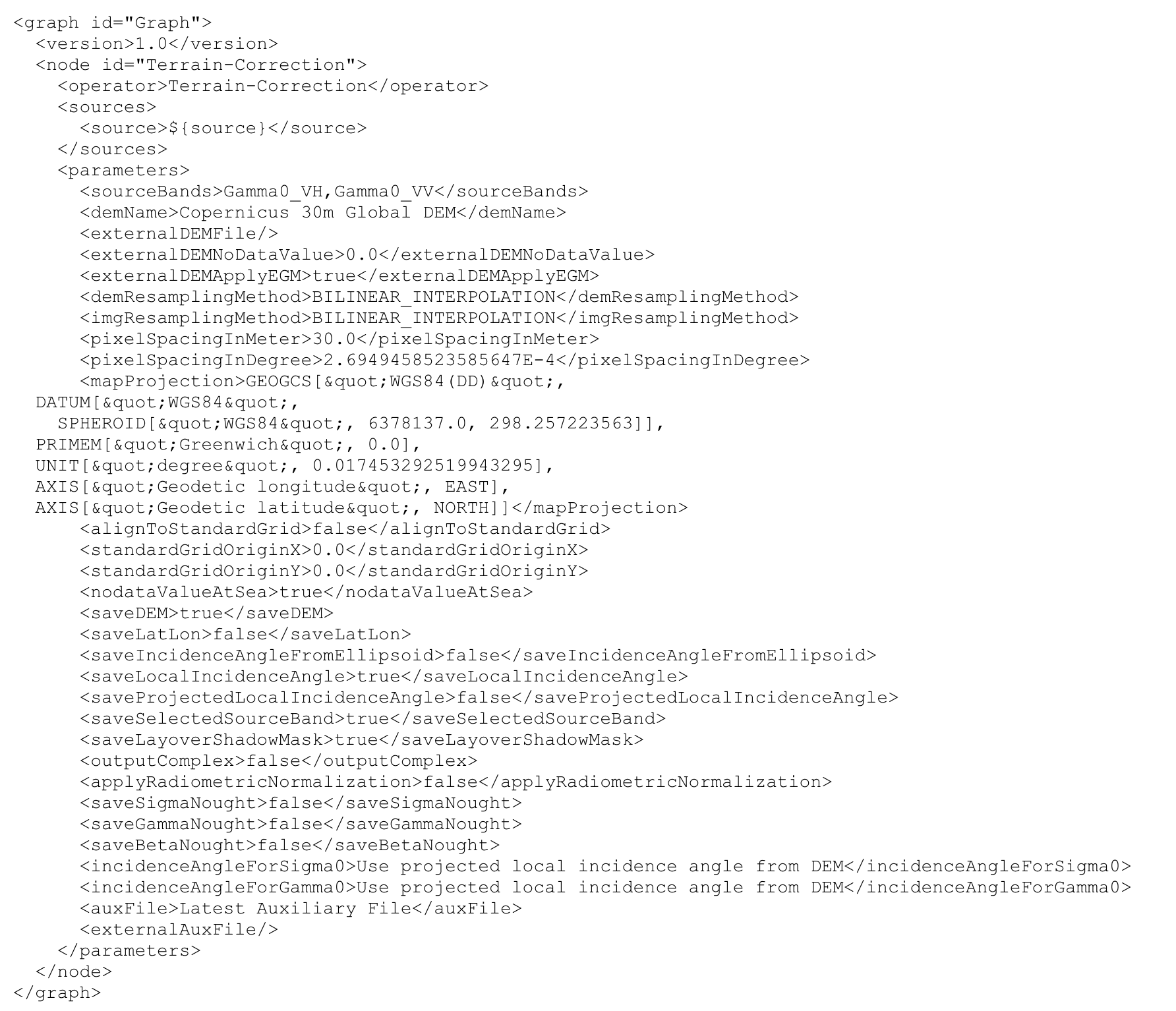
tc graph xml:
error message (clipped to keep it reasonably short):
INFO: org.esa.snap.core.gpf.operators.tooladapter.ToolAdapterIO: Initializing external tool adapters
INFO: org.esa.snap.core.util.EngineVersionCheckActivator: Please check regularly for new updates for the best SNAP experience.
Executing processing graph
SEVERE: org.esa.snap.core.dataio.ProductIO: Error attempting to read S1B_IW_GRDH_1SDV_20210311T035502_20210311T035529_025962_0318C5_3EC5.dim with plugin reader org.esa.s1tbx.io.risat1.Risat1ProductReaderPlugIn@b7d2d51
java.lang.NullPointerException
at org.esa.s1tbx.io.risat1.Risat1ProductReaderPlugIn.findMetadataFile(Risat1ProductReaderPlugIn.java:59)
at org.esa.s1tbx.io.risat1.Risat1ProductReaderPlugIn.findMetadataFile(Risat1ProductReaderPlugIn.java:78)
at org.esa.s1tbx.io.risat1.Risat1ProductReaderPlugIn.getDecodeQualification(Risat1ProductReaderPlugIn.java:44)
at org.esa.snap.core.dataio.ProductIO.getProductReaderForInput(ProductIO.java:304)
at org.esa.snap.core.gpf.common.ReadOp.initialize(ReadOp.java:163)
at org.esa.snap.core.gpf.internal.OperatorContext.initializeOperator(OperatorContext.java:528)
at org.esa.snap.core.gpf.internal.OperatorContext.getTargetProduct(OperatorContext.java:298)
at org.esa.snap.core.gpf.Operator.getTargetProduct(Operator.java:385)
at org.esa.snap.core.gpf.graph.NodeContext.initTargetProduct(NodeContext.java:77)
at org.esa.snap.core.gpf.graph.GraphContext.initNodeContext(GraphContext.java:199)
at org.esa.snap.core.gpf.graph.GraphContext.initNodeContext(GraphContext.java:182)
at org.esa.snap.core.gpf.graph.GraphContext.initNodeContext(GraphContext.java:182)
at org.esa.snap.core.gpf.graph.GraphContext.initOutput(GraphContext.java:166)
at org.esa.snap.core.gpf.graph.GraphContext.(GraphContext.java:85)
at org.esa.snap.core.gpf.graph.GraphContext.(GraphContext.java:58)
at org.esa.snap.core.gpf.graph.GraphProcessor.executeGraph(GraphProcessor.java:118)
at org.esa.snap.core.gpf.main.DefaultCommandLineContext.executeGraph(DefaultCommandLineContext.java:86)
at org.esa.snap.core.gpf.main.CommandLineTool.executeGraph(CommandLineTool.java:547)
at org.esa.snap.core.gpf.main.CommandLineTool.runGraph(CommandLineTool.java:391)
at org.esa.snap.core.gpf.main.CommandLineTool.runGraphOrOperator(CommandLineTool.java:287)
at org.esa.snap.core.gpf.main.CommandLineTool.run(CommandLineTool.java:188)
at org.esa.snap.core.gpf.main.CommandLineTool.run(CommandLineTool.java:121)
at org.esa.snap.core.gpf.main.GPT.run(GPT.java:60)
at org.esa.snap.core.gpf.main.GPT.main(GPT.java:37)
at sun.reflect.NativeMethodAccessorImpl.invoke0(Native Method)
at sun.reflect.NativeMethodAccessorImpl.invoke(NativeMethodAccessorImpl.java:62)
at sun.reflect.DelegatingMethodAccessorImpl.invoke(DelegatingMethodAccessorImpl.java:43)
at java.lang.reflect.Method.invoke(Method.java:498)
at org.esa.snap.runtime.Launcher.lambda$run$0(Launcher.java:55)
at org.esa.snap.runtime.Engine.runClientCode(Engine.java:189)
at org.esa.snap.runtime.Launcher.run(Launcher.java:51)
at org.esa.snap.runtime.Launcher.main(Launcher.java:31)
at sun.reflect.NativeMethodAccessorImpl.invoke0(Native Method)
at sun.reflect.NativeMethodAccessorImpl.invoke(NativeMethodAccessorImpl.java:62)
at sun.reflect.DelegatingMethodAccessorImpl.invoke(DelegatingMethodAccessorImpl.java:43)
at java.lang.reflect.Method.invoke(Method.java:498)
at com.exe4j.runtime.LauncherEngine.launch(LauncherEngine.java:84)
at com.install4j.runtime.launcher.UnixLauncher.start(UnixLauncher.java:66)
at install4j.org.esa.snap.runtime.Launcher_gpt.main(Unknown Source)
INFO: org.hsqldb.persist.Logger: dataFileCache open start
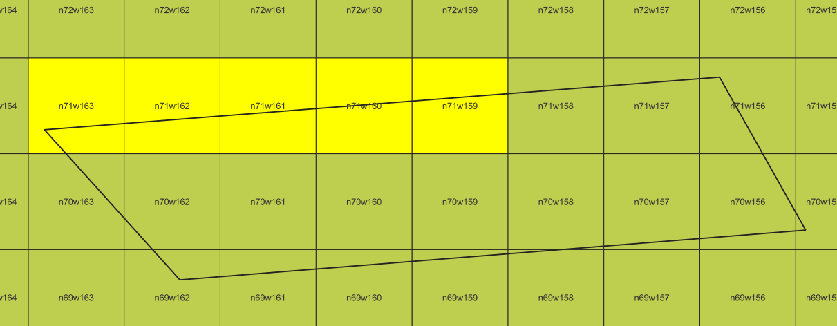
.Copernicus_DSM_COG_10_N71_00_W159_00_DEM.tif
Copernicus_DSM_COG_10_N71_00_W160_00_DEM.tif
Copernicus_DSM_COG_10_N71_00_W161_00_DEM.tif
Copernicus_DSM_COG_10_N71_00_W162_00_DEM.tif
Copernicus_DSM_COG_10_N71_00_W163_00_DEM.tif
Cannot create layover/shadow mask due to the absent of DEM
Cannot create layover/shadow mask due to the absent of DEM
Cannot create layover/shadow mask due to the absent of DEM
Cannot create layover/shadow mask due to the absent of DEM
Cannot create layover/shadow mask due to the absent of DEM
Cannot create layover/shadow mask due to the absent of DEM
Cannot create layover/shadow mask due to the absent of DEM
Cannot create layover/shadow mask due to the absent of DEM
Cannot create layover/shadow mask due to the absent of DEM
Cannot create layover/shadow mask due to the absent of DEM
Cannot create layover/shadow mask due to the absent of DEM
Cannot create layover/shadow mask due to the absent of DEM
Cannot create layover/shadow mask due to the absent of DEM
Cannot create layover/shadow mask due to the absent of DEM
Cannot create layover/shadow mask due to the absent of DEM
Cannot create layover/shadow mask due to the absent of DEM
Cannot create layover/shadow mask due to the absent of DEM
Cannot create layover/shadow mask due to the absent of DEM
Cannot create layover/shadow mask due to the absent of DEM
Cannot create layover/shadow mask due to the absent of DEM
Cannot create layover/shadow mask due to the absent of DEM
Cannot create layover/shadow mask due to the absent of DEM
Cannot create layover/shadow mask due to the absent of DEM
Cannot create layover/shadow mask due to the absent of DEM
Cannot create layover/shadow mask due to the absent of DEM
Cannot create layover/shadow mask due to the absent of DEM
Cannot create layover/shadow mask due to the absent of DEM
Cannot create layover/shadow mask due to the absent of DEM
Cannot create layover/shadow mask due to the absent of DEM
Cannot create layover/shadow mask due to the absent of DEM
Cannot create layover/shadow mask due to the absent of DEM
Cannot create layover/shadow mask due to the absent of DEM
Cannot create layover/shadow mask due to the absent of DEM
Cannot create layover/shadow mask due to the absent of DEM
Cannot create layover/shadow mask due to the absent of DEM