What is the significance of the map projection option in the terrain correction stage of pre-processing a Sentinel 1 GRDH product? The default is to maintain WGS84 geographic coordinates. I want to conduct spatial analysis of the image so need to project to a suitable CRS.
There area many reasons why you want your data differently projected, for example because you want to combine it with data of different origin, or because you need equal area or equidistant projections. Every projection has pros and cons:
1 Like
Thanks for your reply. I suppose the question I am trying to ask is whether it is better to project at the preprocessing stage rather than transform the image file to a projection later on.
I projected during SNAP preprocessing using UTM, which was read in another GI system as an ESRI reference. I then had to change to a recognised EPSG code for UTM30N for other layers to be able to project on the fly.
Always map project as the last step.
1 Like
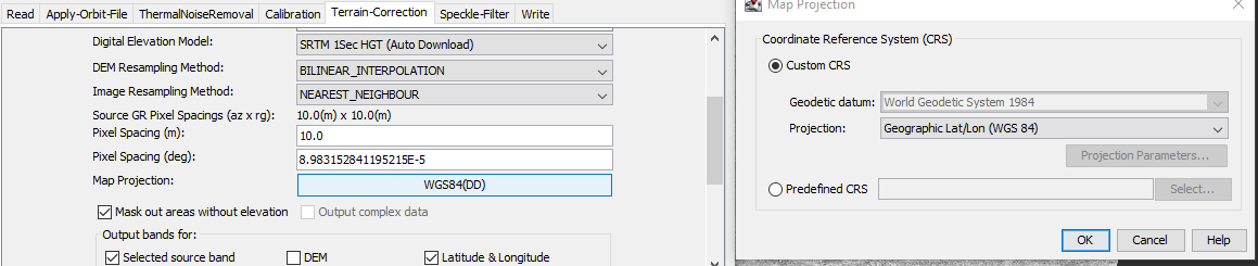
Thanks mengdahl. In Graph Builder I have chosen not to project the output file as the image below. However when I load the image into QGIS, a UTM projection has been applied. Does anyone know why this occurs?
Can you please show a screenshot of QGIS?

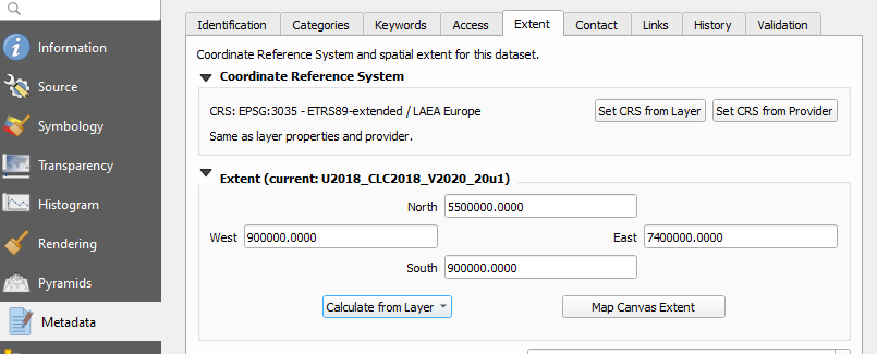
thank you. Can you please double-check under Layer Properties > Information
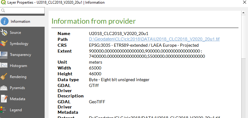
and also Layer Properties > Metadata > Extent > Set CRS from Layer > Calculate From Layer


That is strange indeed. Does this happen every time? Is a graph involved here?

can you please check in the xml file of the graph if the CRS was entered correctly (WGS 84 shouldbe EPSG:4326 instead of EPSG:102580)
When I open the saved graph, the kml includes reference to a UTM projection as below

When I click on the map projection button (no other action), there is no reference to UTM in the kml file as below

I will run the graph now to check the output
can you please share the graph as an xml file in here?
RUS_training_graph_nospecklefilter.xml (6.4 KB)
Here’s the kml file
yes, the graph has stored UTM 30 as target coordinate reference system.
To me it would make sense to re-create the graph by yourself and define WGS84 as target CRS and save it as a separate XML. Maybe the graph provided by RUS is based on different data so it’s not fully transferable.
Yes will do. I think its a glitch with the graph builder as simply clicking on the map projection button clears any reference to UTM. Thanks for your help. Really appreciated