Hi,
I recently used Snap to project an External DEM (RGE Alti) over an area of interest for which I had Sentinel-1 data.
To achieve this, I provided the DEM (as a GeoTIFF) during the Terrain Correction step of my process.
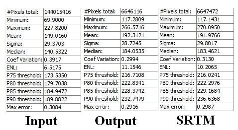
One issue I noticed was that the elevation values are modified between the input and the output for some reason. I don’t believe this is a resampling error: we’re talking about a 40m offset on average over the area of interest.
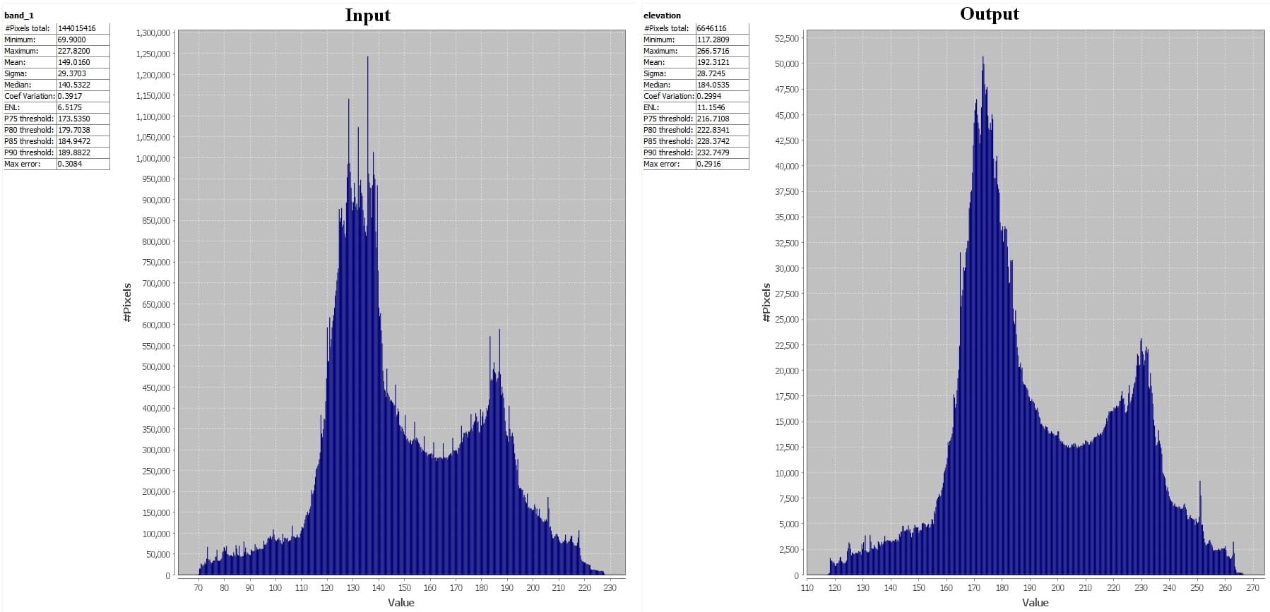
When I compared the output elevation values with the auto-downloaded SRTM, I saw that they were similar. However, the input elevation values fit what Google Earth shows for the area of interest.
What could cause this significant elevation difference? Is it just a matter of altitude of reference?
How would Snap know how to offset my external DEM?