Today, when I do Range-Doppler Terrain Correction step in SNAP software. I encountered an error.
The source data name is S1B_EW_GRDM_1SDH_20180102T202501_20180102T202538_008997_010101_5963.
The result data of TC step is as Fig. 1, I have marked the corresponding serial numbers in the Fig.You can easily found that the result image is not present according to the north orientation. WGS 84 / Arctic Polar Stereographic (EPSG:3995) is be chosen as coordinate system. Besides, the result is shown in correct north orientation when coordinate system is setting to UTM. Therefore, I think maybe SNAP exists some errors in conversion step when coordinate system is Arctic Polar Stereographic .
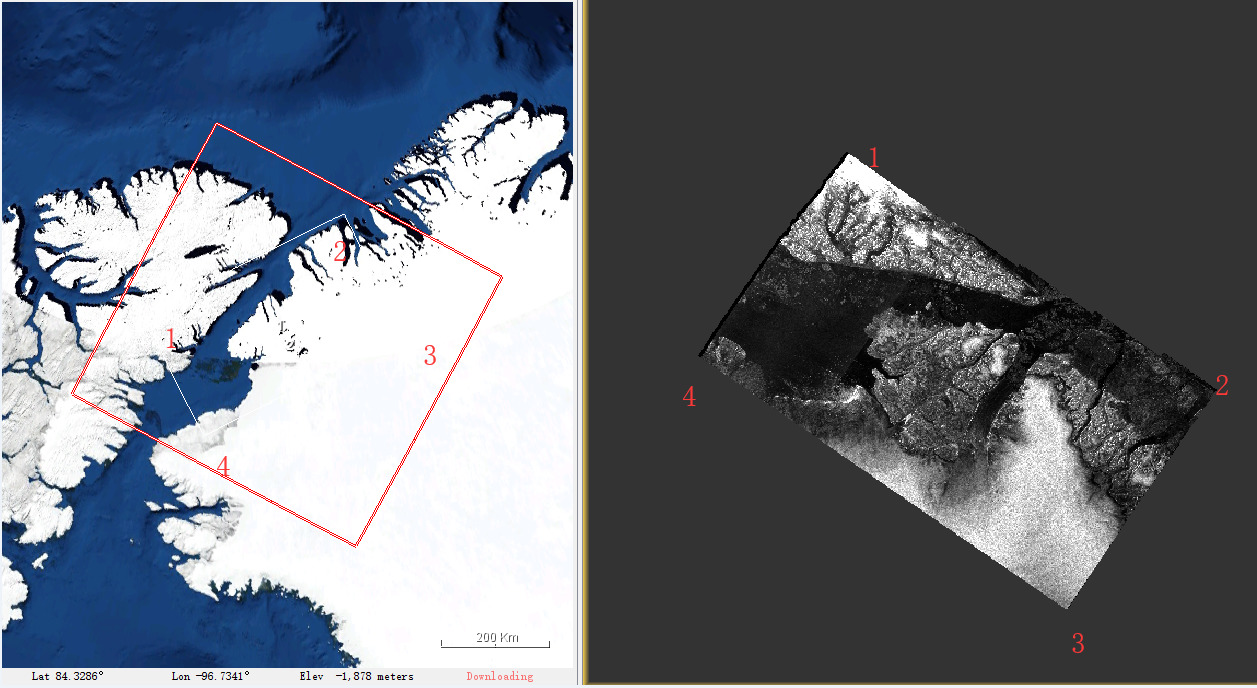
Fig.1
I don’t know the accurate reason for the phenomenon.Thanks for your reply in advance.