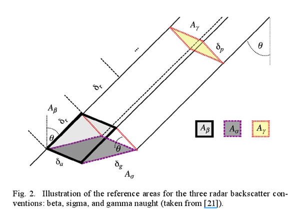
Please check the paper from 2012-TGRS-Improving PolSAR Land Cover Classification With Radiometric Correction of the Coherency Matrix, “The reference areas used within the , and backscatter conventions are illustrated in Fig. 2. Each convention employs its own definition of the backscatter reference area, placing it in: 1) the slant range plane itself ( with area ) the ground as modeled by an ellipsoidal Earth ( with area ); or 3) the plane perpendicular to the local look direction ( with area ) [26].”
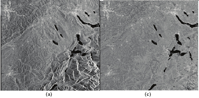
and 2009-TGRS-A Revised Radiometric Normalisation Standard For SAR, the figure above shows SAR image before and after terrain-flatten which removes the stereoscopic sensation.
after the ideal radiometric correction, your radiometric variable no matter sigma/beta or gamma-naught, should not be a function of local incidence angle.

