I want to create coherence rasters from 3 TerraSAR-X datasets.
I know the general process flow to create coherence rasters from SLC, but I’m not very sure of the coregistration bit. For Sentinel data, we usually go with 2000 gcps. Does the number of gcps in the cross-correlation tab affect the accuracy of co-registration?
The number of GCPs determines how likely good cross correlations between both images are found in the first place. They are randomly distributed over the image and tested for their statistical likelihood in both images. All GCPs with no statistical correlation are dropped. The more GCPs you seed, the higher ist the chance that you will end up with a sufficient number of matches which allow an adjustment of the slave image to the master (mostly based on a polynomial). If not GCPs are found, the slave image will be empty (black).
Given that a sufficient number is found, the accuracy of the coregistration increases with more GCPs. There are cases when increasing the number of GCPs also increases the risk of false matches which distort the final coregistration, so I’d an unnecessary high number is not helpful.
1 Like
Dear @ABraun
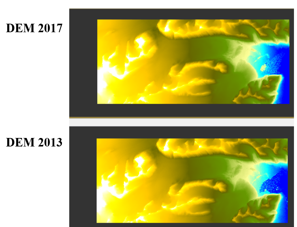
I made two DEMs over a glacier in 2013 and 2017. You can find them in below.
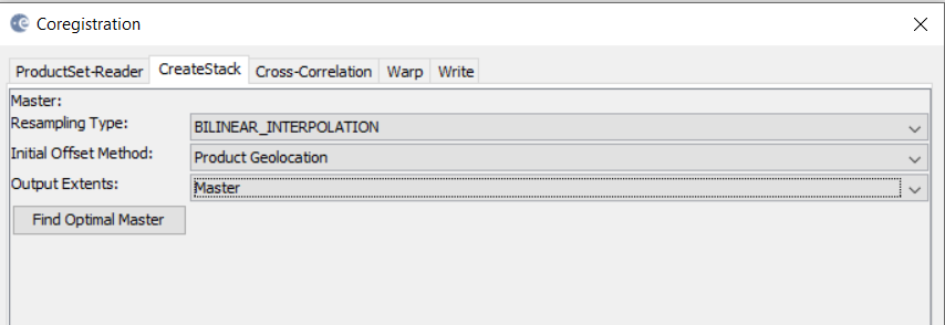
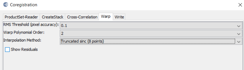
Then I tried to coregister them by using (radar—coregisteration----coregistartion). Then I put below items:
STEP1:
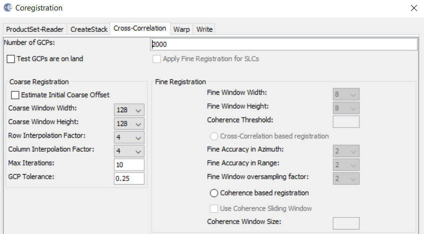
STEP2:
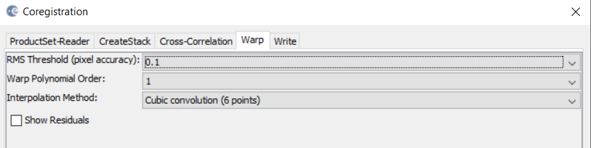
STEP 3:
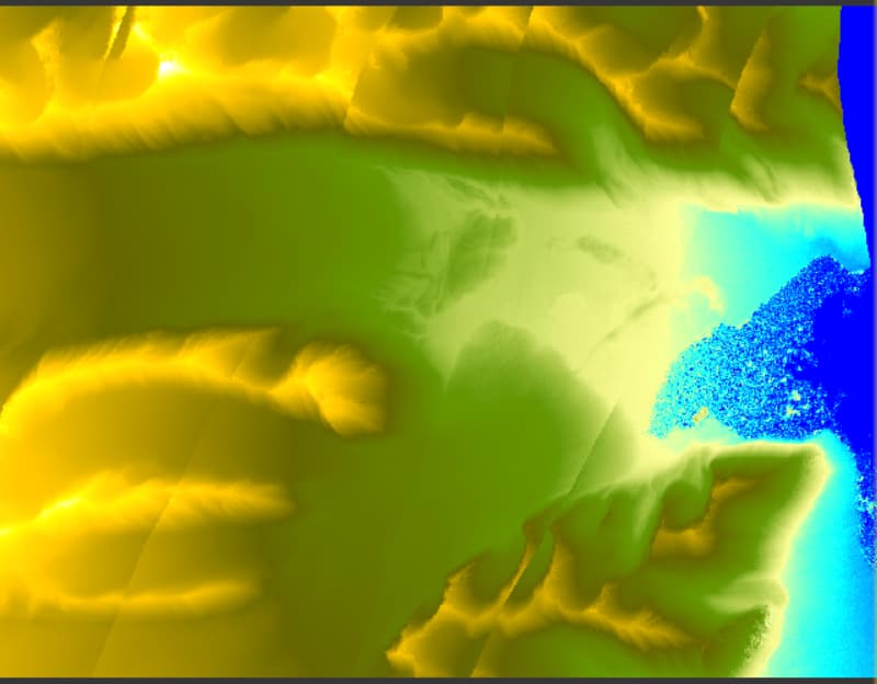
And the result is in below after co-registration:
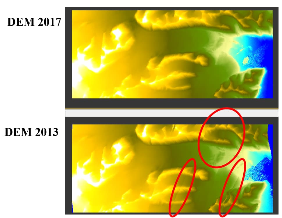
But, I do not know why I have distortions in red areas. Shall I change some items?
I searched but I did not find similar topic. I hope I did not repeat this question.
Thanks.
Are you sure that coregistration is the correct tool for this task? Small artefacts could result in falsely identified GCPs which could then lead to the observed distortions.
As a first test, I would increase the number of GPCs to reduce the proportion of potentially faulty outliers.
Also, try a second order polynomial with truncated sinc interpolation.
DEM 2013 has 6310*2783
And
DEM 2017 has 6342*2775
So to make them in equal dimension, the way is coregistration.
Do you know another way?
I increased them from 2000 to 8000 but no difference in the result.
I used below:
But no difference and I still have those distortions.
If both are already terrain corrected you can directly create a stack under Coregistration > Stack Tools > Create Stack.
Yes, thanks. It works now.