Hello all,
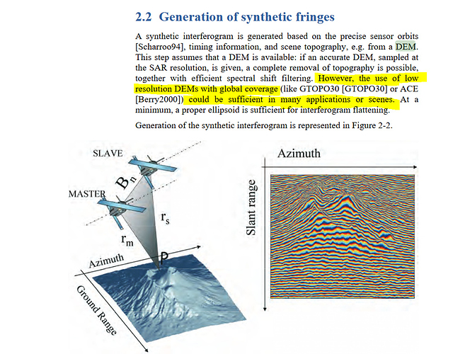
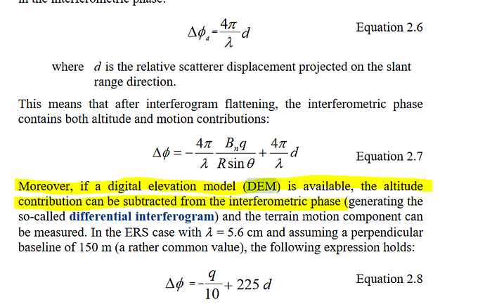
I have some questions about the Topographic phase removal issue. I am using S-1A or B and the spatial res of the interferogram is almost 30 meters but I am using SRTM 3 arcsec for Topographic Phase removal and the res is 90 meter. So how the SNAP program adjusts the pixels for correction as doing downsampling or upsampling? I need to remove Topo Phase into the interferogram but I am not sure to use SRTM 1 arc second or 3 arc second. If I use SRTM 1 arc sec both are 30 m resolution but it is so time-consuming. Please, can anybody enlighten me?
Good works
Fikret
This is done in the step of backgeocoding, the DEM resolution isn’t subjected to any change,
Generally at the moment the downloading SRTM 3 sec has problem of downloading, Technically I think with S-1 there is no large effect.
1 Like
Thanks @falahfakhri,
But if you are working on the area in which contains high elevation, the interferogram needs to Topo phase remove whether you use S1 or not. Yeah, I recognized it couldn’t download SRTM 3’’, there is a problem.
Fikret
In any case of interferometric phase displacement extraction, topo phase removal should be done to exclude the height from the equation; However area with high elevation might be subjected to unwrapping phase problem especially in the long Perpendicular Baseline scenario case.
1 Like

