Hello everyone! I’m newbie in this forum, so if I’ve just done something wrong please forgive me
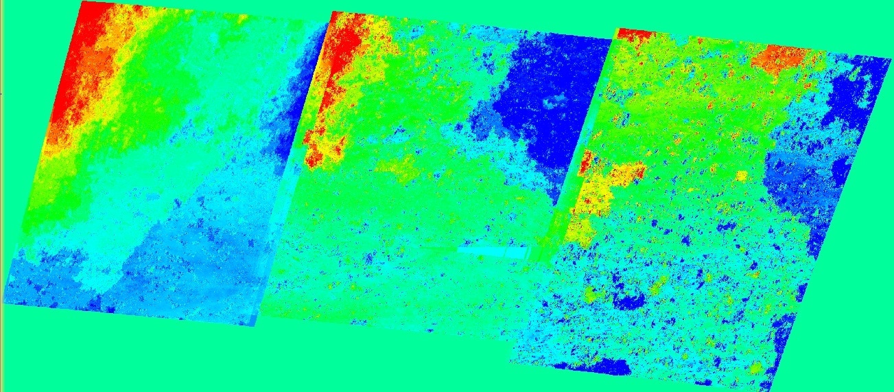
I need to build Earth vertical displacements of big territory for many years as much as possible. I’ve never do this before, so I found many manuals with various advices. In short I was following the next steps:
picked up Sentinel-1B images with Bperp < 50 meters and Btemp around 12 days.
coregistration
interferogram formation
deburst
topophase removal
goldstein filtering
phase unwrapping
phase to displacement
terrain correction
export to TIFF
In all cases I used standard preferences except “export” in “unwrap” - I entered in “row” & “column” 20 instead 10.
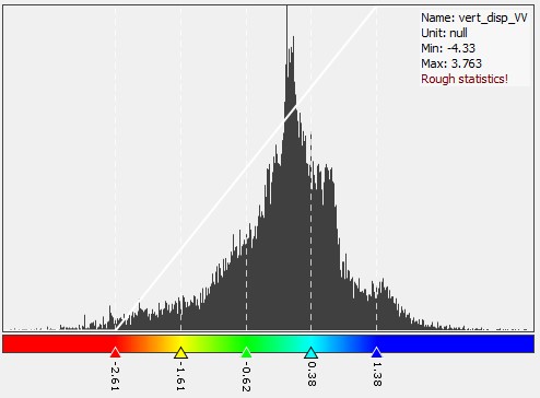
In step 8 I used two different solutions. 1) standard function in SNAP; and 2) I created new band with this expression:
(Unw_Phase * 5.55) / (-4 * PI * cos(rad(incident_angle))).
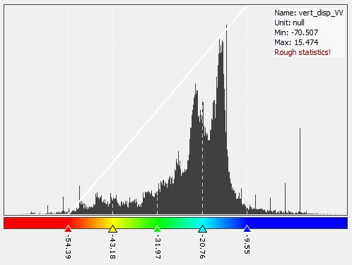
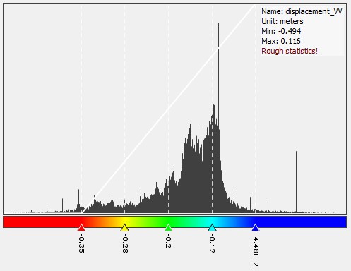
The pictures were become similar but with different values.
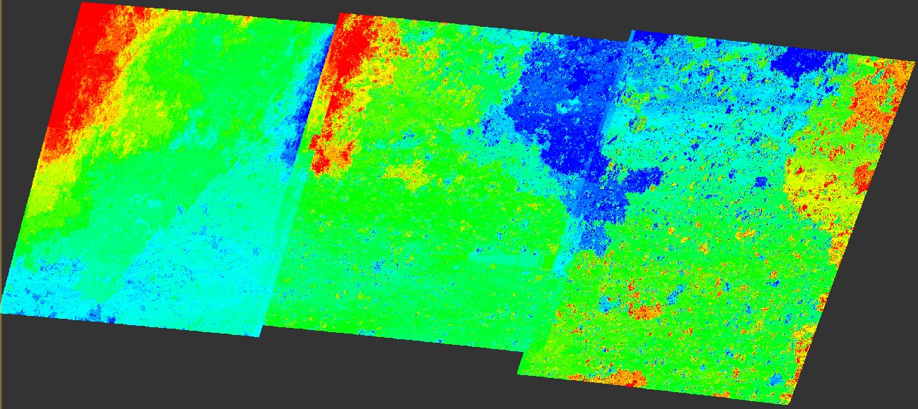
Contrary to your understanding, the selection of VV or HH polarization does not primarily result in vertical or horizontal displacements. Both measure the change of elevation along the line of sight. There are many topics discussing how to get absolute displacements but this is not possible with a single scene and also not implemented in SNAP.
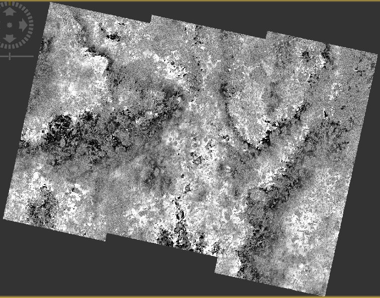
Your processing steps seem correct but probably the perpendicular baseline is not ideal, also the quality of the orbit files plays a role, especially if the data looks “ramped” like in your case.
Also it would be worth trying a different DEM for the topographic phase removal and compare if the output makes more sense.
Finally, as you are working on very large areas and the final resolution will probably of minor importance I would suggest multi-looking to about 30 meters (the resolution of SRTM 1Sec) after the debursting. Of course this reduces the spatial resolution but the outcome is less prone to unwrapping errors and these kind of ramps could be avoided. I personally think having more realistic displacements over the full area is more important than the size of the final pixels.
I’m sorry for my long response for you - personal circumstances.
@ABraun Thanks a lot for your advices, that’s exactly what I needed =) Yes, you’re right. I need realistic displacements. It’s more important than the size of the pixels.
I did all the things you said. The only thing I’ve changed is multi-looking was done before snaphu import. Idk, but final image was as so rough as early when I did multi-looking after the debursting.
I have 2 questions about your advices:
Am I right when I’ve tried DEM “SRTM 1Sec HGT” at all operations I’ve done?
Am I right when I’ve entered such value in “Number of Range Looks”, that “Mean GR Square Pixel” was equal around 30?
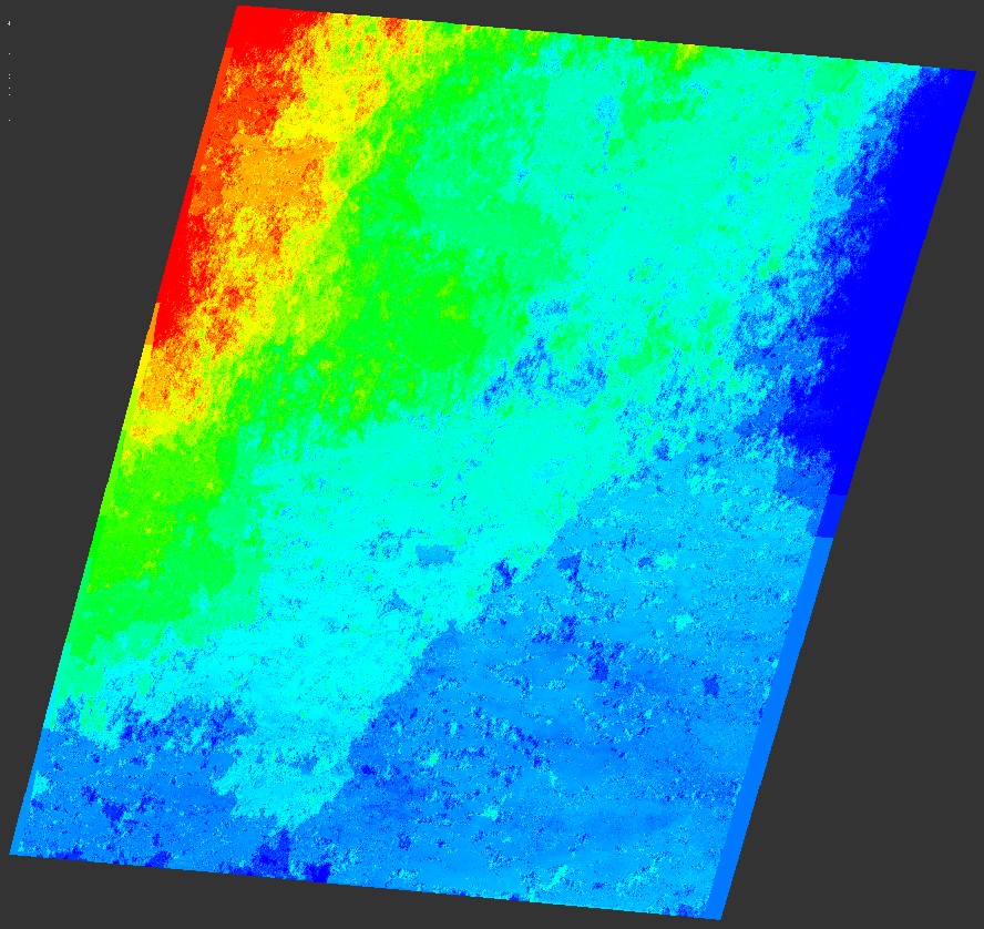
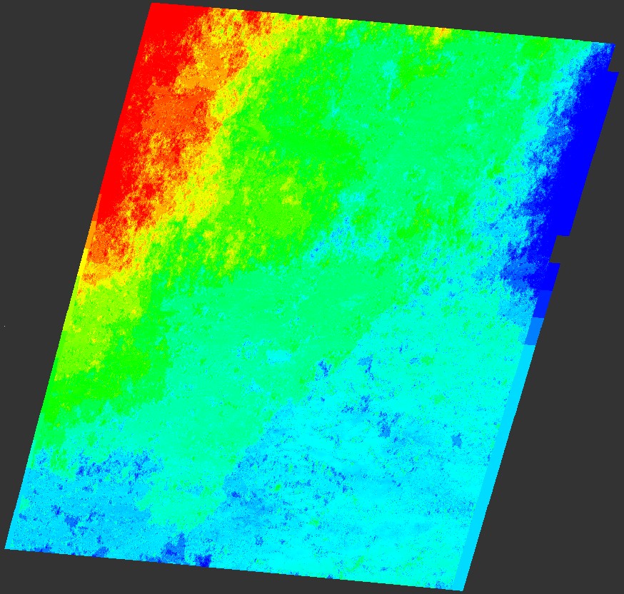
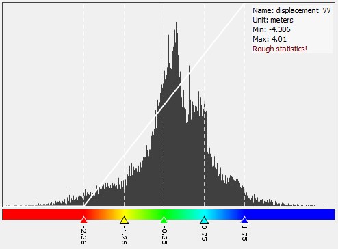
The derived pictures of the same area displacements. I hope the pictures are become more realistic and suitable: