After Atmospheric Correction, CHRIS images have pixel values (surface reflectance) more than 1 (up to 3000 in NIR band), I think there exists a scale factor that makes surface reflectance much bigger than it should be. When I calculate EVI (Enhance Vegetation Index=2.5float(b15-b7)/float(b15+6b7-7.5*b1+1)∈ [0,1]),EVI values exceed the threshold of 1 due to the existence of scale factor. I have looked through CHRIS toolbox Atmospheric Correction Module ATBD and algorithm description (Guanter,2006,Spectral calibration of hyperspectral imagery using atmospheric absorption features), however,neither of them have mentioned above this, so how can I convert the output of Atmospheric Correction into normal surface reflectance which ranging from 0 to 1?
I guess you have exported the data to GeoTiff. In this case only the raw data is stored to the file. If you stay with BEAM-DIMAP or NetCDF the scaling is kept.
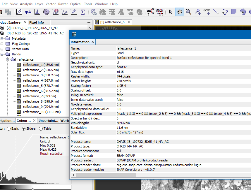
To get the correct values for your data you need to multiply the values with 0.0001.
In SNAP you can find the scaling factor used by a band by opening the information dialog.
1 Like
Thank you very much!!! I did export data to GeoTiff, I really appreciate your help !