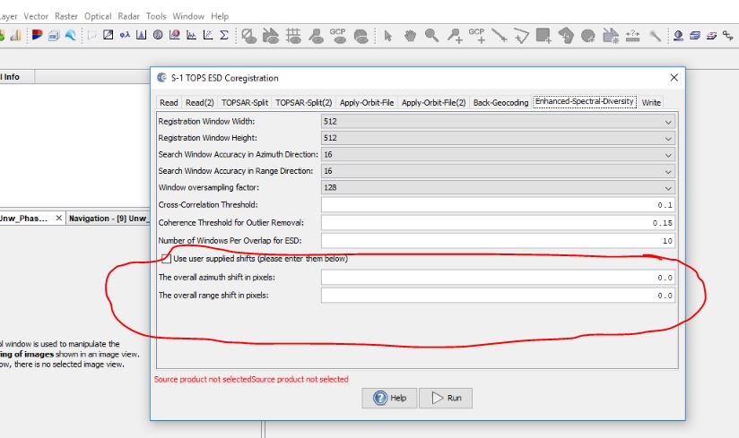
I have two SAR images of an earth quack scene (S1A Sentinel 1). I have did all processing regarding the interferogram and I have got now the phase displacement but I only have a doubt about the TOPS ESD co registration processing especially the Azimuth shift in pixel and Range shift in pixel as I accepted as default (0 )value!. the problem when I overlay the wrapped phase image on the final phase displacement, it seems a bit not Geo-referenced!
Thanks for your swift reply!
Yes, I applied the Range Doppler Terrain Correction in the very final step in the processing but with SRTM 3ArcSec(AutoDownload)
But I left the Azimuth and Range shift pixel as default, Does that not affect the final product in terms of Georeferencing?
such question are better placed in the puublic forum. This one in the s1tbx category.
For example, I have no much knowldge about SAR processing. If you ask public in the forum everyone can answer. You will get the full power of the forum.
And others can benfit from the discussion too.
I’ ll make it public