I know all of UAVSAR GRD products are geocode although i can’t export any products in POLSARPRO V6 in GEOTIFF formats and i dont know how geocode matrix T3 in POLSARPRO or ASF mapready. I want classifition with polarimetric decomposition and deep learning model
Geocoding in ASF MapReady is quite simple:
Load UAVSAR data and select these three options
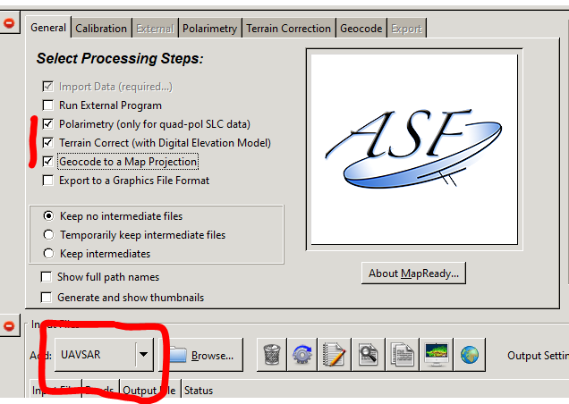
The first lets you compute decompositions, the second asks for a DEM for terrain correction and the last allows the export to a geocoded GeoTiff.
1 Like
hi, I have tried these steps, but the result showed that “Terrain correction of uavsar data is not supported.” I don’t know what the problem with, are there any steps that I should pay more attention to ?
“Not supported” means thar SNAP cannot read UAVSAR data correctly.
You can try geocoding it with ASF MapReady (also free)