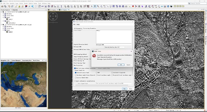
Hello friends on the forum,I’m having a problem with the fit of using snap software,the picture show the problem.This SAR image is Umbra satellite data.how can i fix it ,thanks for everybody.
the image type is TIFF , i do not know why it can not be recongnized
The short answer is at present you cannot. Umbra data and metadata products are distributed in SICD format (specifically Polar Format Algorithm within SICD) that is pretty much not used by anyone outside the defense community. None of the open source tools in the science community typically handles this format. You may have some luck using sarpy to work with this dataset, if you understand SICD terminology. If you are working with a GEC, you can just treat it like any geospatial dataset but you won’t be able to do any SAR related operations on it.
Thank you .I’ll think of a way again
Hello. I am working on an UMBRA SAR product and run into similar issue. Could you please share with me what approach you ended up using that worked? Thanks for your assistance.
Depends on what you are trying to do with this data. If you just want to geocode the data, you can give this a shot: GitHub - forrestfwilliams/MultiRTC: A python library for creating ISCE3-based OPERA RTCs for all modern SAR missions (eventually)
Thanks very much. I was hoping to do both terrain correction and radiometric calibration. This will be useful for terrain correction but doesn’t support UMBRA radiometric calibration at the moment. Do you per chance know of another package that can help with that?
I do not think high resolution sensors primarily designed for object detection are great for radiometry without a large number of looks, which defeats the purpose of the higher resolution. I’m not aware of any tools that works with PFA SICD data but again these types of imaging modes are not typically not meant to be used for applications that rely on radiometry.
Thank you very much. I appreciate your assistance.
