Unable to get fractional land/water mask

Whenever I try to run fractional Land/water mask by graph builder or with the help of the tool in SNAP GUI
SNAP stops responding. where am I doing wrong ?
mask maskgui ,

I think the direction of the last part in your graph is incorrect,

And, What are the selection parameters?

Actually, I kept it correct only, but it wasn’t taking and displaying in wrong direction then later not responding.

Sorry I have no idea,

but In general your SNAP dosen’t respond or only to this operator?

It is not responding to this operator only.

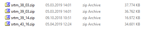
SNAP has problems with acessing SRTM 3Sec data lately.

You can manually download the corresponding tile and place it in the folder

.snap\auxdata\dem\SRTM 3Sec\

where it must exactly match this file format (zip) and naming convention
grafik

In land water mask generation does SNAP use SRTM 3sec data by default ?

unfortunately, yes

can we change that ?

only in the source code.

One more thing. Can I get a separate band of land/water mask in the same product as we get elevation band along with backscatter coefficient band(using tool “Add elevtion band”) ?

you could just add the elevation band and extract all negative values as non-land pixels

Any reference for this.

nothing special, simple band maths.

The land/water mask operator does not include backscatter intensity at all, it simply uses a DEM to remove pixels with no elevation. It won’t detect temporary water bodies or small rivers.

Sigma0

SRTM

Band Maths

image

Result

It looks good but I want to remove the permanent water bodies from my data so that I am left with only flood.

  1. Does this technique serve the purpose accurately?

  2. I heard of SRTM water body mask . Is it also depends only on the DEM data? If yes, below what altitude they consider it as water body in preparation of mask?

depends on the spatial resolution of your DEM. You see in my example that it is coarser than the spatial resolution of the SAR data.

this varies for different parts of the world. You have to find out for your study area.

I will resamle the 50mtr resolution data to the sentinel 1 resolution. In this case, Will it be fine?

If I say, my study area is whole India. what would you say ?

yes, SRTM with 30 m should be fine then

simply have a look at the elevation data, play around with the thresholds in the band maths. I really cannot tell you. It is probably not the same height for all of India’s coasts.

1 Like

Thank You for your valuable suggestions .