Hello everyone,
I’m new to GRD image processing and have been encountering some difficulties along the way.
My goal is to perform terrain correction (RTC) using GAMMA software on a series of Sentinel-1 GRD images for a specific area and time window. As part of the RTC process with DEM-matching, GAMMA requires the creation and refinement of a look up table. Since the same pivot table can be reused for all images of same time series (images of same area with identical acquisition geometry) I need to identify unique scenes—I mean, scenes from the same relative orbit that cover the same geographic area.
(However, I’m unsure whether such consistent scenes exist. It’s not clear to me if all GRD images are acquired using the exact same combination of bursts and sub-swaths in each pass. This uncertainty is where I’m currently facing issues.)
Building a consistent time series is also important for me because I plan to apply multi-temporal speckle filtering later on.
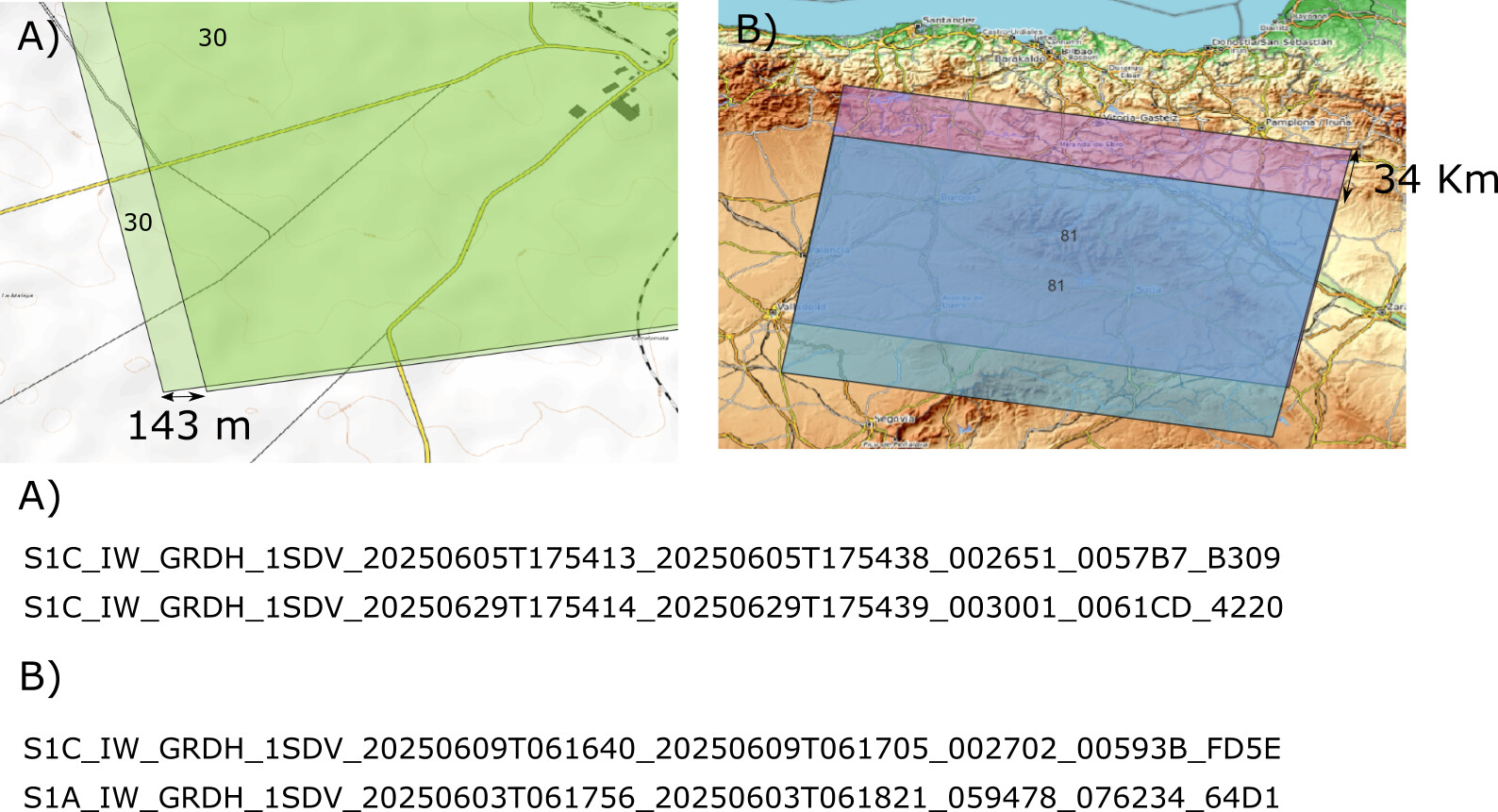
I’m currently extracting coordinates from the footprint variable in the manifest.safe file, but I’m finding that images from the same relative orbit over the same area often have differing footprints. In some cases, the difference between image corners is about 143 meters (Fig A), while in others, it’s up to 34 kilometers (Fig B).
At this point, I’m quite stuck and unsure how to proceed, since
- GRD scenes does not have any ID at all?
- should I co-register or stacking them prior to terrain-correcting them?
Any help or guidance would be greatly appreciated.
Thank you very much in advance!