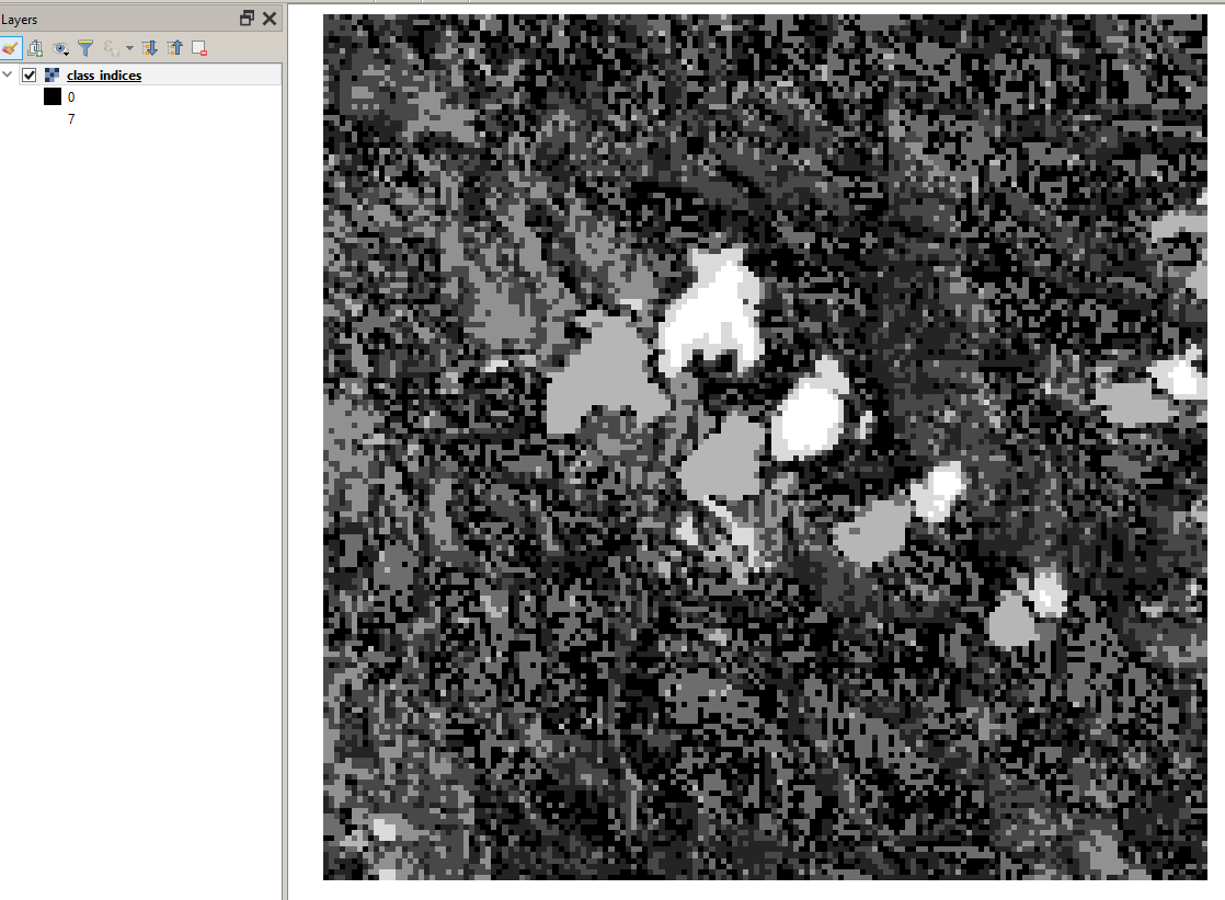
to export the raster values, you can simply take the class_indices.img file inside the .data folder of your output. It is fully compatible with other GIS software (e.g. QGIS)
The spectral signatures are within the … _kmeans.dim file of your classification product. You can open it with any text editor and find the thresholds under Dataset Sources
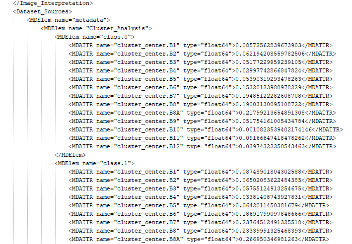
If you remove all other parts and save it as an xml file (example: kmeans.xml) you can even import it into Excel.