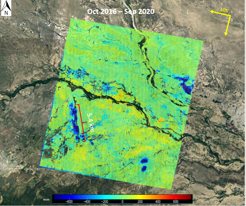
Anthropic activities can modify the ground surface in different ways. We made a study using satellite-based InSAR technics over a mine region in the north of México. As we can see, there are some areas that suffer subsidence due to mining and water extraction for agriculture.
The study was made with Sentinel-1 imagery from October 2016 to September 2020. We identified until 70 cm of subsidence in Line-of-sight. This information can contribute to the understanding of ground surface dynamic associated with anthropogenic activities over the place and provide useful information to mitigate risks and disasters in the mine operations.
Reference:
GMTSAR (Sandwell, D. ., R. . Mellors, X. Tong, M. Wei, and P. Wessel (2011), Open radar interferometry software for mapping surface deformation, Eos Trans. AGU, 92(28), doi:10.1029/2011EO280002.)
Satellite: Copernicus Sentinel-1(ESA)